


Where are the Ozark Mountains?
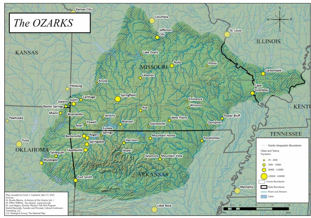
The Ozark Mountains, or simply the Ozarks, is a group of highlands in south-central United States. The majority of the mountains lie in southern Missouri and northern Arkansas, but the range also stretches into Oklahoma, Kansas. and Illinois
How Long are the Ozark Mountains?
The Ozarks are roughly 300 miles (483 kilometers) in length and 200 miles (322 kilometers) in width. This represents an extensive area of approximately 47,000 square miles (120,000 square kilometers) across the American Midwest. It is the most extensive highland region between the Appalachian and Rocky Mountains.
What States are the Ozark Mountains in?
The Ozarks span across five states:
- Missouri: Dominates the Ozarks’ landscape, featuring the expansive Ozark Plateau.
- Arkansas: Home to the Ozark National Forest and the picturesque Arkansas River Valley.
- Oklahoma: Host to a smaller portion of the Ozarks into its northeastern territories.
- Kansas: The Ozarks touch this state’s southeastern fringe.
- Illinois: Known as the Illinois Ozarks, this area is made up of the Shawnee Hills.
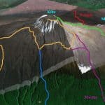
The Ozark Mountains are comprised of several subregions: Boston Mountains, Springfield Plateau, White River Hills, Salem Plateau, and the St. Francois Mountains.
Boston Mountains: Located in the southern part of the Ozarks, primarily in Arkansas, the Boston Mountains are known for their steep slopes and high peaks. This area represents the highest and most rugged part of the Ozarks.
Springfield Plateau: Based in southwestern Missouri, this area is noted for its karst topography, featuring numerous sinkholes, caves, and springs. The Springfield Plateau is also where the city of Springfield, often considered the cultural heart of the Ozarks, is located.
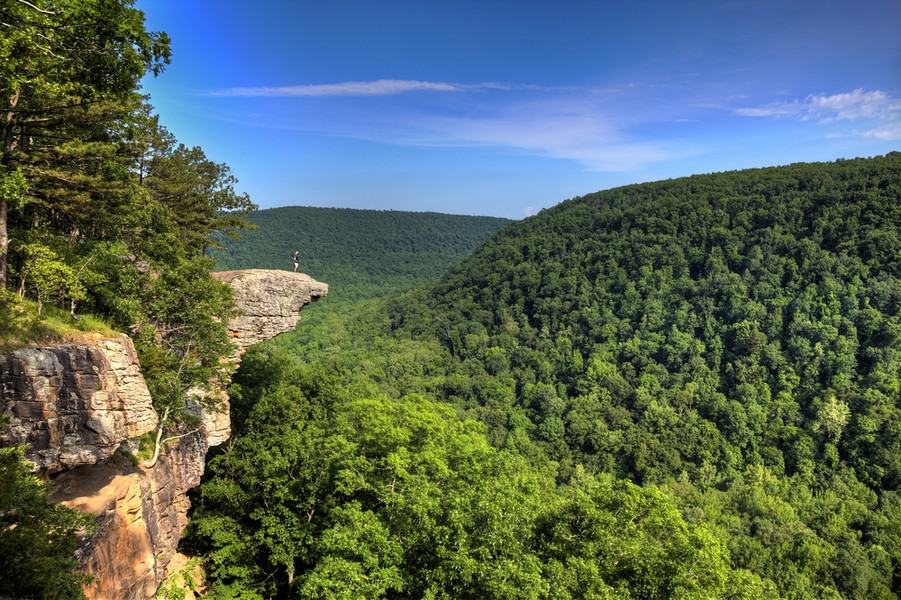
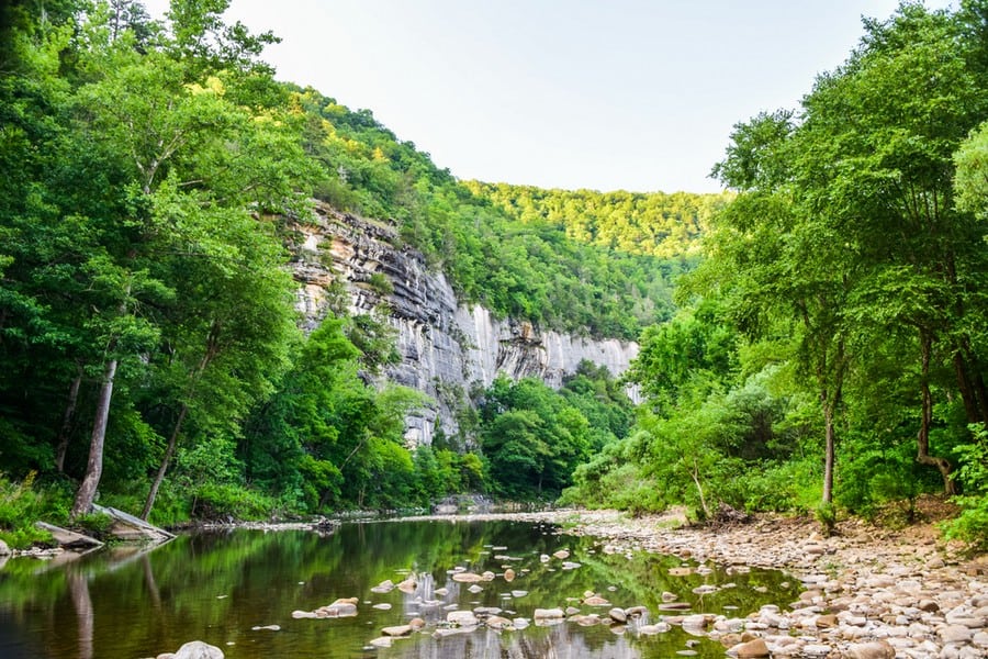
White River Hills: With their rugged terrain and attractive scenery, the White River Hills are known for their forested slopes, limestone cliffs, and scenic lakes.
Salem Plateau: Extending into southern Missouri and northern Arkansas, the Salem Plateau is characterised by its dense forests, rolling hills, and clear rivers.
St. Francois Mountains: Centrally located within the Ozarks, these mountains stand out geologically and topographically as the core of the region. This area features both linear and cone-shaped mountains.
Where Do the Ozark Mountains Start and End?
The Ozarks are spread out over a broad area. They start in the central portion of Missouri and end in northern Arkansas. Additionally, it extends into the northeastern segment of Oklahoma, the southeastern corner of Kansas, and part of Illinois.
The geographical boundary is complex due to the plateau-like nature of the region. They don’t have a clear start and end point. Instead, the mountains gradually blend into surrounding terrain. However, the core area of the Ozarks is well-defined, with the Springfield Plateau, Salem Plateau, and the Boston Mountains forming its heart.
How Did the Ozark Mountains Form?
The formation of the Ozark Mountains spanned hundreds of millions of years. But unlike the Rocky Mountains, which arose from the collision of tectonic plates, these structures emerged through the erosion of a massive plateau.
This plateau was once a high and relatively flat surface. It was composed of ancient rocks that had crystallised deep within the Earth’s crust. Over eons, these rocks were uplifted, forming a highland region that stood above the surrounding terrain.
In time, the forces of erosion—water, wind, and ice—began to sculpt the plateau. Rivers carved deep valleys, and streams etched out the hills, gradually wearing down the high plateau to reveal the rugged, rolling topography of the Ozarks.
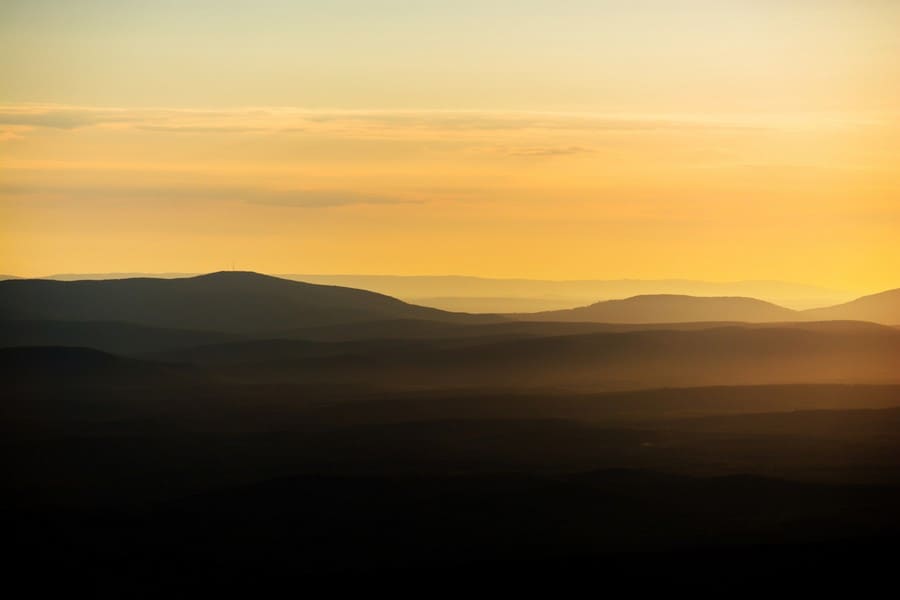
How Big and Tall are the Ozarks?
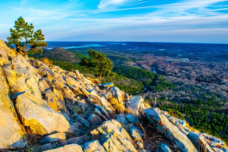
The Ozarks are modest mountains that do not reach the heights of other ranges.
The highest point is Buffalo Lookout in Arkansas, which reaches a height of approximately 2,561 feet (780 meters) above sea level. Another notable peak is Taum Sauk Mountain in Missouri, which stands about 1,772 feet (540 meters) tall.
What are the Most Famous Features of the Ozark Mountains?
The most popular features of the Ozarks include:
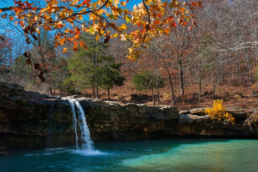
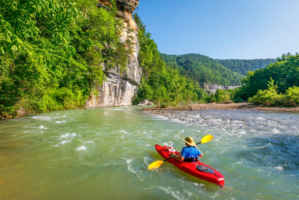
- Buffalo National River: Distinguished as America’s inaugural National River.
- Ozark National Scenic Riverways: A national park dedicated to preserving a wild river system.
- Ozark and Mark Twain National Forests: Large stretches of unspoiled nature, named in honor of Missouri’s legendary author.
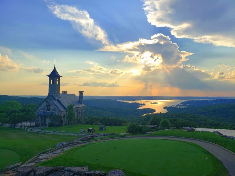
- Branson and Eureka Springs: These towns are known for their vibrant entertainment scenes and rich history.
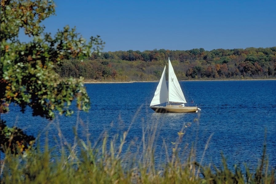
- Table Rock Lake and Lake of the Ozarks: Reservoirs famous for fishing and boating.
- Pea Ridge National Military Park: A well-preserved Civil War battlefield.
What are Some Notable Peaks in the Ozarks?
The notable peaks in the Ozarks inculde:
- Buffalo Lookout: The highest point in the Ozarks at 2,561 feet (780 meters).
- Taum Sauk Mountain: Missouri’s highest peak at 1,772 feet (540 meters).
- Magazine Mountain: Arkansas’s tallest peak at 2,753 feet (839 meters).
- Whitaker Point: Famous for its crag and stunning views, especially during autumn.
- Driskill Mountain: A modest peak in Louisiana at 535 feet (163 meters).
- Bell Mountain: Offers one of the most difficult hikes in Missouri.
- Black Mountain: Known for its remote and rugged landscape.
- Pilot Knob: A historic mountain with panoramic views and significant Civil War history.
- Shepherd Mountain: Features challenging trails with scenic overlooks.
- Mudlick Mountain: Recognized for its unique geological features and natural springs.
What are Some Notable Hikes in the Ozarks?
The Ozarks offer a variety of trails:
- Whitaker Point Trail (Hawksbill Crag): A 3-mile round trip offering views of the Buffalo National River valley.
- Lost Valley Trail: A family-friendly 2.2-mile round trip in the Buffalo National River area, featuring natural bridges, caves, and a beautiful waterfall.
- Devil’s Den State Park Trails: This park offers a 15-mile path known as the Butterfield Hiking Trail.
- Glory Hole Waterfall Trail: A 2-mile round trip leading to a unique waterfall that pours through an eroded hole in the roof of an overhang.
- Buffalo River Trail: Spans approximately 37 miles along the Buffalo National River.
- Centerpoint to Goat Trail: A moderate 6-mile round trip offering views of the Big Bluff and the Buffalo River from one of the tallest sheer bluffs in the area.
- Sam’s Throne Trail: A 2-mile round trip that takes hikers to one of the rock formations in the Ozarks.
- Pedestal Rocks Loop Trail: A 2.2-mile loop that showcases pedestal rocks and natural arches.
- Big Piney Creek Trail: A 36-mile trail known for its beautiful creek and wildlife viewing.
- Hercules Glades Wilderness Trails: Offers over 32 miles of trails.
- Ozark Highlands Trail: One of the longest in the Ozarks, this trail stretches over 165 miles.
- Taum Sauk Mountain State Park: Features the Mina Sauk Falls Trail, a 3-mile loop leading to the state’s tallest waterfall.
What is the Weather Like in the Ozarks?
The climate in the Ozarks varies significantly by elevation.
Summers are notably warm, with temperatures frequently ascending into the range of 85°F to 90°F (29°C to 32°C). This period often witnesses high humidity, making the air feel considerably warmer. Conversely, winters are cold, with temperatures typically falling between 20°F and 40°F (-6°C to 4°C). Snowfall occurs, but accumulation is generally modest compared to more northern climates.
When is the Best Time to Visit?
Spring and autumn are arguably the best times to visit the Ozarks. We recommend going from May to June or from September to October. During these times, temperatures are mild, commonly ranging from 50°F to 70°F (10°C to 21°C).
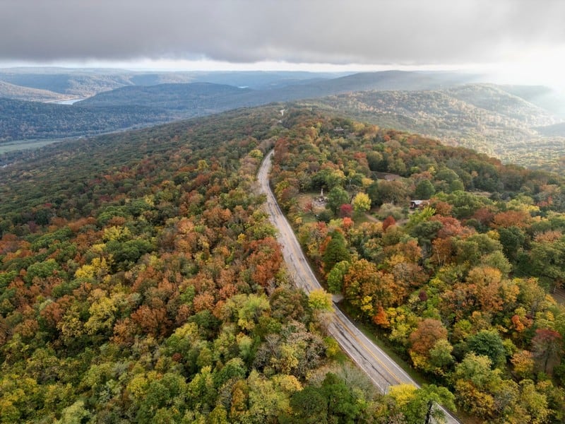
Spring brings blooming wildflowers and a rejuvenation of the landscape, whereas autumn showcases a colorful display of fall foliage.
What Plants and Animals Can Be Found?
The Ozark Mountains have a variety of habitats that sustain a diverse range of plant and animal life.
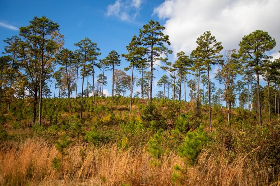
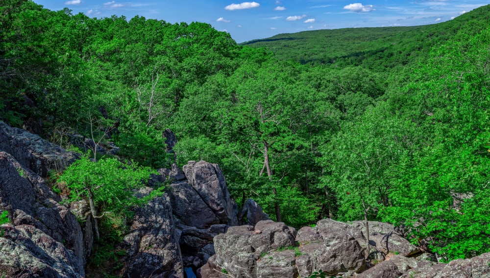
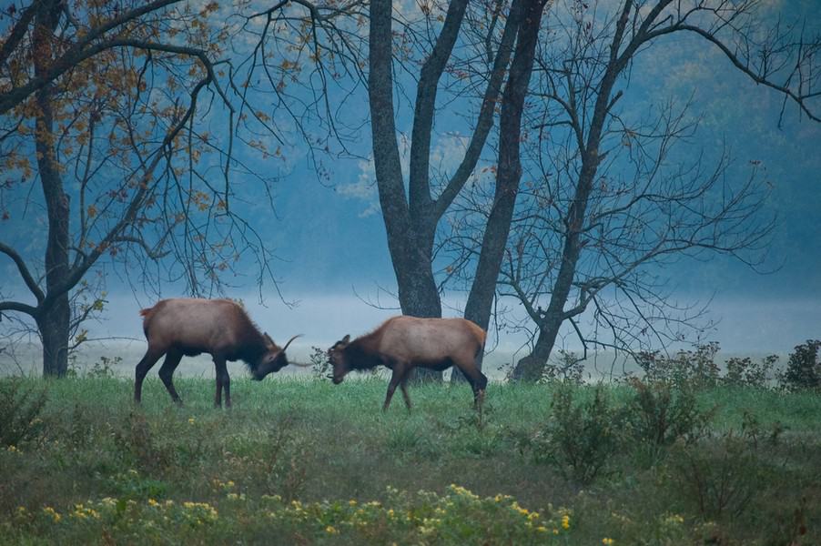
Forested Areas: The hardwood forests, primarily oak and hickory, are home to white-tailed deer, elk, black bears, coyote, fox, bobcats, wild turkeys, and smaller mammals, such as the eastern gray squirrel, chipmunks, and the raccoon.
River Systems: The rivers and streams support fish (smallmouth bass, Ozark bass), turtles (map turtle, snapping turtle), and other aquatic species (Ozark Hellbender). River otters, once almost wiped out by hunters, have been successfully reintroduced to the area. Otters, mink, beaver and muskrat are also found here.
Caves and Karst Landscapes: The cave systems are home to species such as the endangered Indiana bat, gray bat, and cave crayfish.
Open Meadows and Glades: These grassy areas serve as habitats for the eastern collared lizard, rattlesnakes, and a variety of insects, including butterflies and bees.
Who Lived in the Ozarks?
The first inhabitants of the Ozarks were indigenous tribes, with the Osage, Quapaw, and Caddo among the most notable.
Following European exploration and settlement, the Ozarks witnessed significant cultural shifts. Europeans brought with them new technologies, languages, and customs, which altered the landscape and the way of life. The 19th century saw an influx of settlers from the Appalachian region, drawn by the promise of fertile land and new opportunities. These settlers introduced practices such as logging and mining.
Throughout the 18th and 19th centuries, the native people were displaced due to American expansion. The Osage were resettled in what is now Osage County, Oklahoma. The Quapaw were forcibly moved to northeastern Oklahoma. And the Caddo were relocated multiple times, finally landing in present-day Oklahoma, then known as Indian Territory.
In the 20th century, the Ozarks became a melting pot of cultures, as people from various backgrounds continued to settle in the area. This cultural diversity is reflected in the Ozarks’ traditions, which include a blend of music, folklore, and craftsmanship.


")
")


")
