


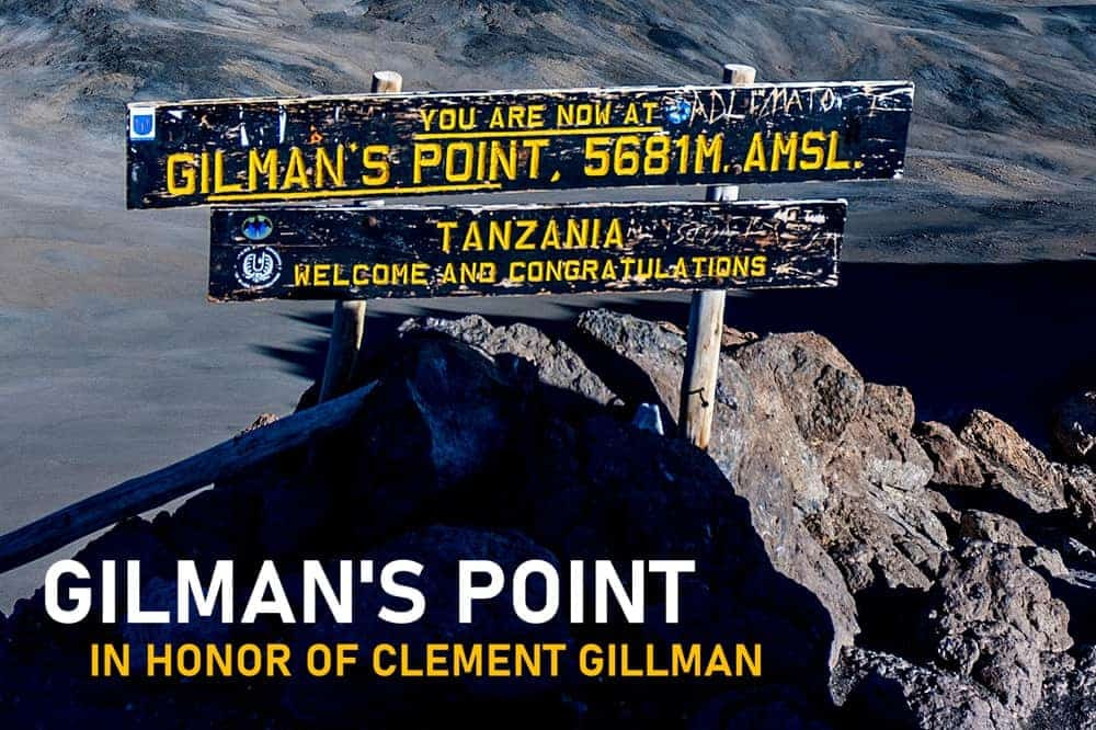
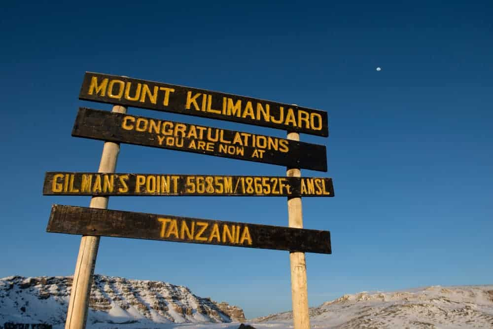
(Gilman’s Point, located on the crater rim of Mount Kilimanjaro, is the lowest of three summit points on the peak. Situated at an elevation of approximately 18,638 feet (5,681 meters), this spot was named after Clement Gillman, a pioneering East African engineer and geographer.
Who Was Clement Gillman?

Clement Gillman was born in Spain on November 26, 1882—the son of an Anglo-Swiss father and a German mother. Raised in Germany and educated in Switzerland, his early life was a prelude to travel and adventure.
In 1905, he ventured into East Africa to work as a survey engineer for the construction of the Central Railway. This journey marked the beginning of an enduring relationship with the continent.
He lived in East Africa for over four decades. Despite the tumultuous periods of the World Wars and his internment as a civilian prisoner, Gillman’s dedication to scientific exploration never wavered.
Gillman’s post-war years were characterized by his role as a water consultant to the government. His final years were devoted to academic work.
His death in 1946 marked the end of a career that had a lasting impact on the geographical understanding of East Africa. His legacy is evident in his maps and publications, which continue to serve as references for the study of East African geography.
1909 Kilimanjaro Expedition
In the early 20th century, Kilimanjaro was outstanding challenge for explorers and geographers. At the time, there was a big desire to conquer the unknown, with limited technological resources but boundless determination.
Gillman’s initial attempt to climb Kilimanjaro occurred just a few years after his arrival in East Africa, in 1909. Details of this early expedition including the route he took or obstacles he faced weren’t available. While he did not reach the summit, this attempt underscored Gillman’s resolve and interest in Kilimanjaro’s geographical features.
1921 Kilimanjaro Expedition
In 1921, Gillman led a large British expedition aimed at conquering Kilimanjaro. The primary goal of the 1921 expedition was to conduct geographical and scientific studies of Kilimanjaro. The climb to the top was a means to gather data on the mountain’s altitude and environmental conditions.
The timing was notable, coming after World War I, as control of the region shifted from Germany to Britain. Gillman’s ascent on Kilimanjaro would be the first on British territory.
On October 19, 1921, the team made its critical move, aiming for the summit at 19,341 feet (5,895 meters). But on the icy upper reaches, Gillman fell short. He had made it to the crater rim and left the Union Jack as proof of his feat.
This mark, at an elevation of 18,638 feet (5,681 meters), came to be known as Gilman’s Point.
The Naming of Gilman’s Point
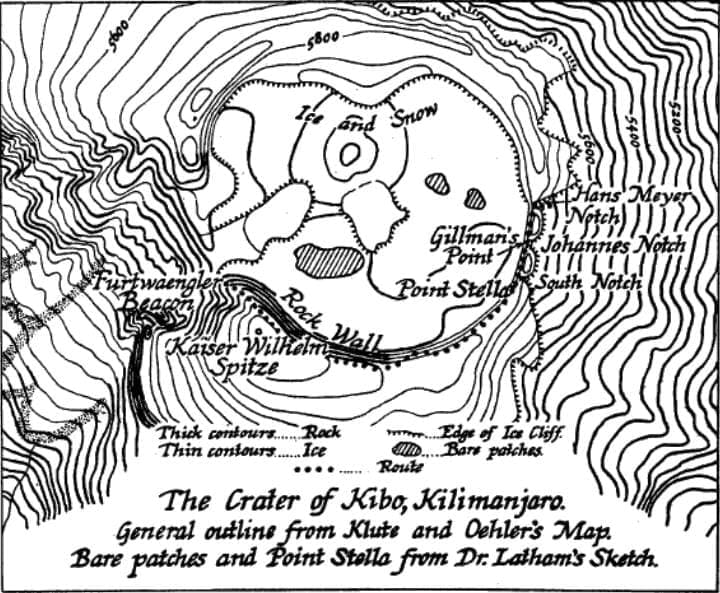
Initially unnamed, Gilman’s Point was identified during mapping efforts by German climbers Fritz Klute and Eduard Oehler in 1912. The site was later named after Gillman as a recognition for his contribution to Kilimanjaro’s exploration and his broader work in East African geography. Despite his initial objection to the naming, he eventually took pride in this honor.
Gillman’s contributions continued until his death. He died on a flight from Dar es Salaam to Moshi on October 5, 1946. It is noted that he passed “with his pencil in his hand and his notebook on his knee, within sight of Kilimanjaro, the mountain he knew so well.”
Gillman’s work extended beyond the slopes of Kilimanjaro.
His surveys and studies helped lay the groundwork for future developmental projects. His work in railway engineering and hydrology provided a deeper understanding of East Africa’s environmental opportunities. And his publications and maps have become foundational resources in the field.
Fun Fact
On Kilimanjaro, Gillman employed the Siedepunkt-Meßmethode, a method that utilizes the boiling point of water to determine altitude. Recognising that water’s boiling point decreases approximately 10°C for every 3,000 meters in elevation, Gillman calculated that at Gilman’s Point, water would boil at 81.06°C.


