


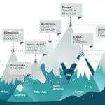


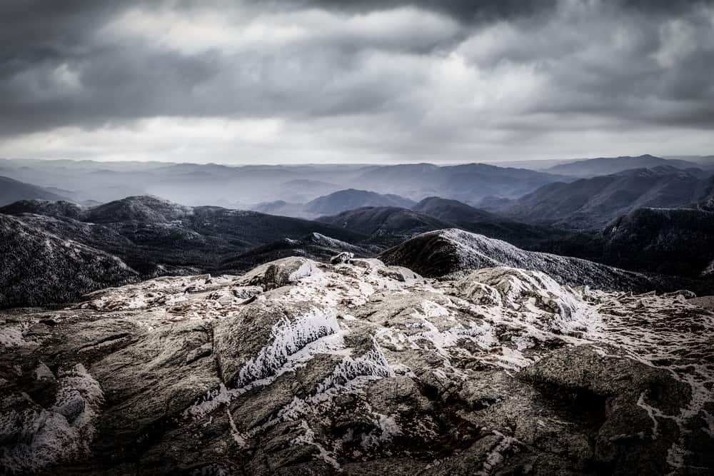
Why is the Elevation Across the United States So Varied?
The elevation in the USA is highly diverse compared to many other nations.
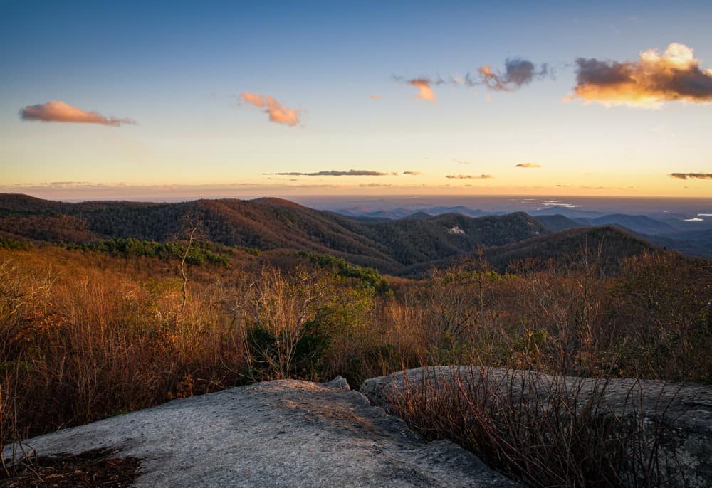
This diversity stems from the country’s vast geographical expanse, which encompasses a wide range of latitudes, climates, and geological features. The United States includes some of the world’s most extensive mountain ranges, such as the Rockies and the Appalachians, the vast central plains, the volcanic peaks of the Pacific Northwest, and the low coastal areas along the Atlantic and Pacific Oceans.
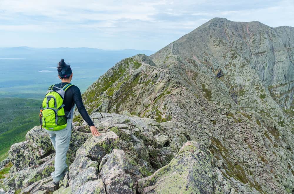
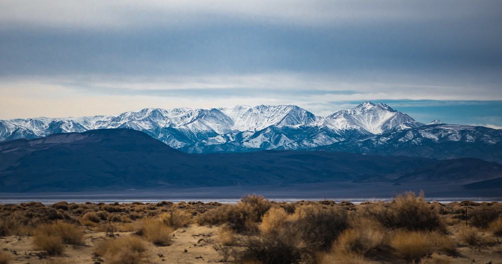
This variation in topography results in a wide range of elevations, from the highest point at Denali (Mount McKinley) in Alaska, standing at 20,310 feet (6,190 meters), to the lowest point in Death Valley, California, at 282 feet (86 meters) below sea level. Few countries offer such a broad elevation span within their borders, making the United States unique in its topographical diversity.
List of High Points in the USA by State
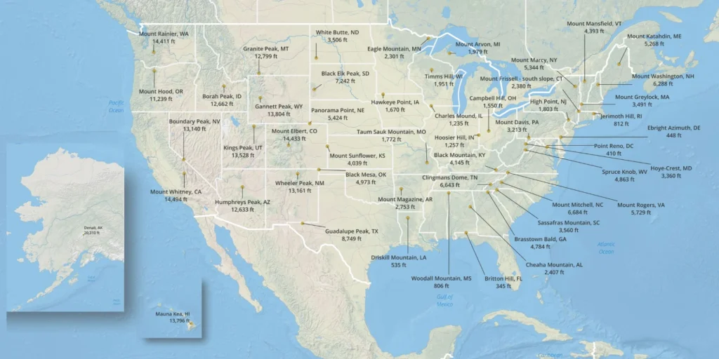
This is a list of the high points for every state:
- Alabama: Cheaha Mountain (2,413 feet/735 meters)
- Alaska: Denali (20,310 feet/6,190 meters)
- Arizona: Humphreys Peak (12,633 feet/3,851 meters)
- Arkansas: Magazine Mountain (2,753 feet/839 meters)
- California: Mount Whitney (14,505 feet/4,421 meters)
- Colorado: Mount Elbert (14,433 feet/4,399 meters)
- Connecticut: Mount Frissell (South Slope) (2,380 feet/725 meters)
- Delaware: Ebright Azimuth (448 feet/137 meters)
- Florida: Britton Hill (345 feet/105 meters)
- Georgia: Brasstown Bald (4,784 feet/1,458 meters)
- Hawaii: Mauna Kea (13,796 feet/4,205 meters)
- Idaho: Borah Peak (12,668 feet/3,861 meters)
- Illinois: Charles Mound (1,235 feet/376 meters)
- Indiana: Hoosier High Point (1,257 feet/383 meters)
- Iowa: Hawkeye Point (1,670 feet/509 meters)
- Kansas: Mount Sunflower (4,039 feet/1,231 meters)
- Kentucky: Black Mountain (4,145 feet/1,263 meters)
- Louisiana: Driskill Mountain (535 feet/163 meters)
- Maine: Mount Katahdin (5,269 feet/1,606 meters)
- Maryland: Hoye Crest (3,360 feet/1,024 meters)
- Massachusetts: Mount Greylock (3,489 feet/1,063 meters)
- Michigan: Mount Arvon (1,979 feet/603 meters)
- Minnesota: Eagle Mountain (2,301 feet/701 meters)
- Mississippi: Woodall Mountain (806 feet/246 meters)
- Missouri: Taum Sauk Mountain (1,772 feet/540 meters)
- Montana: Granite Peak (12,799 feet/3,901 meters)
- Nebraska: Panorama Point (5,429 feet/1,655 meters)
- Nevada: Boundary Peak (13,140 feet/4,005 meters)
- New Hampshire: Mount Washington (6,288 feet/1,917 meters)
- New Jersey: High Point (1,803 feet/550 meters)
- New Mexico: Wheeler Peak (13,161 feet/4,011 meters)
- New York: Mount Marcy (5,344 feet/1,629 meters)
- North Carolina: Mount Mitchell (6,684 feet/2,037 meters)
- North Dakota: White Butte (3,506 feet/1,069 meters)
- Ohio: Campbell Hill (1,550 feet/472 meters)
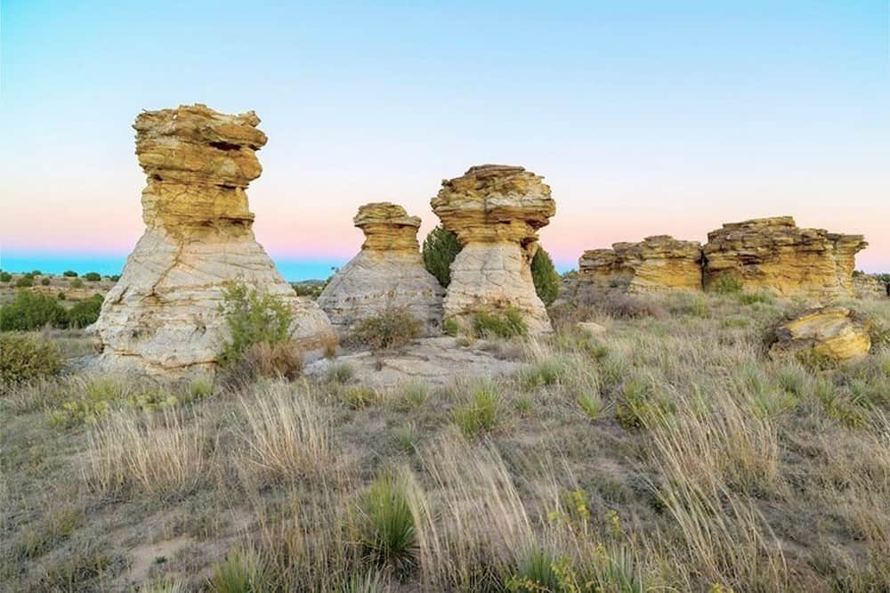
- Oklahoma: Black Mesa (4,973 feet/1,516 meters)
- Oregon: Mount Hood (11,249 feet/3,429 meters)
- Pennsylvania: Mount Davis (3,213 feet/979 meters)
- Rhode Island: Jerimoth Hill (812 feet/247 meters)
- South Carolina: Sassafras Mountain (3,554 feet/1,083 meters)
- South Dakota: Black Elk Peak (7,244 feet/2,208 meters)
- Tennessee: Clingmans Dome (6,643 feet/2,025 meters)
- Texas: Guadalupe Peak (8,751 feet/2,667 meters)
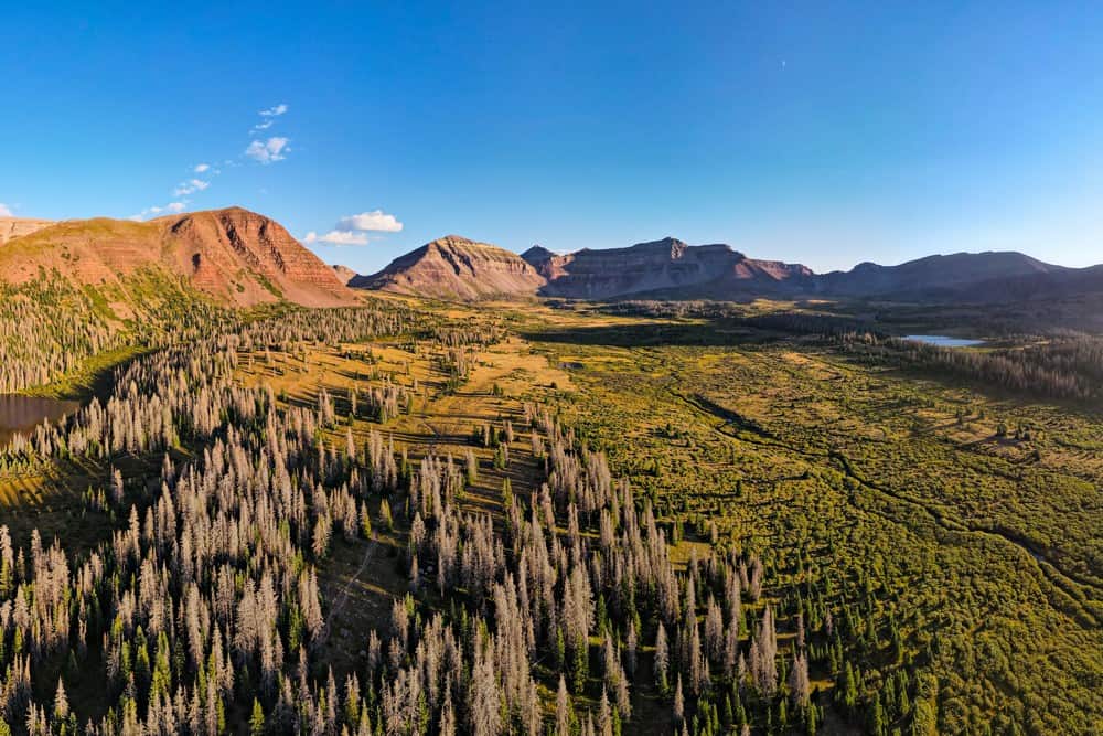
- Utah: Kings Peak (13,528 feet/4,123 meters)
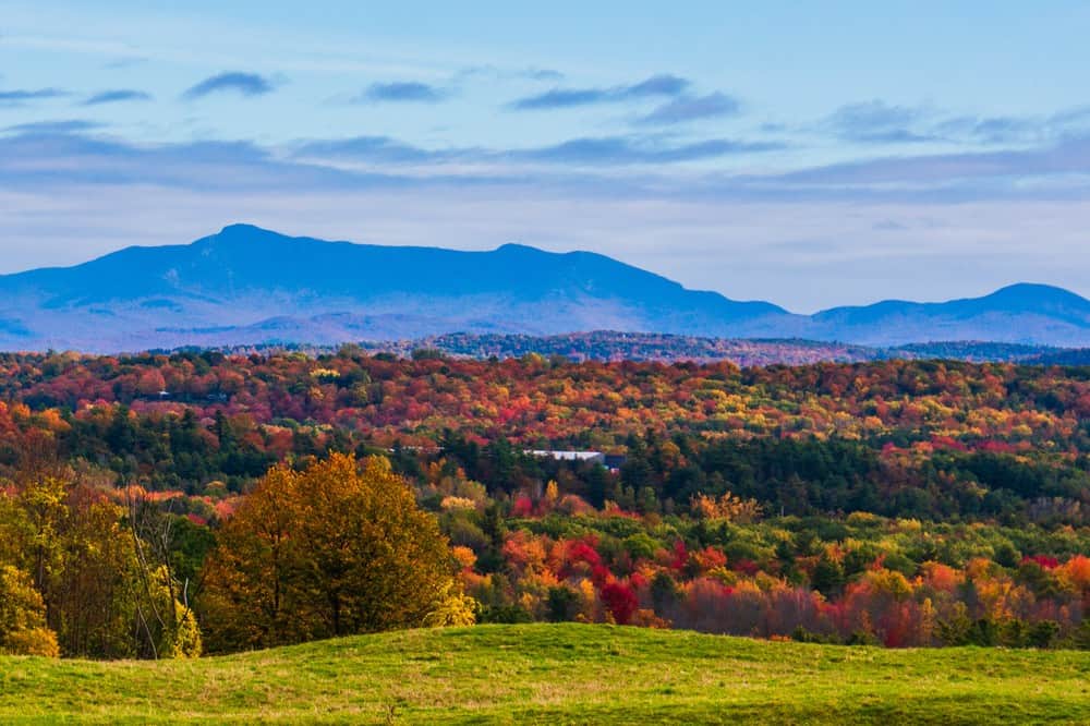
- Vermont: Mount Mansfield (4,395 feet/1,340 meters)
- Virginia: Mount Rogers (5,729 feet/1,746 meters)
- Washington: Mount Rainier (14,411 feet/4,392 meters)
- West Virginia: Spruce Knob (4,863 feet/1,482 meters)
- Wisconsin: Timms Hill (1,951 feet/595 meters)
- Wyoming: Gannett Peak (13,804 feet/4,207 meters)
The Highest Points of Every State
Here is every high point in the United States, by state, including photos and brief descriptions.
Alabama: Cheaha Mountain (2,413 feet/735 meters)
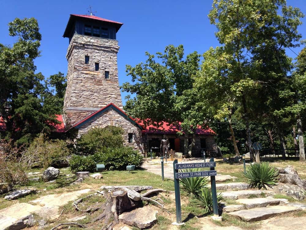
Cheaha Mountain, the highest point in Alabama, is located within the Talladega National Forest. The mountain’s name is derived from the Creek word “Chaha” meaning “high place.” Cheaha Mountain is part of the ancient Appalachian Mountains and is surrounded by Cheaha State Park. This park offers numerous trails, campsites, and panoramic views. The historic CCC-built Bunker Tower at the summit provides visitors with an overlook of Alabama’s vast forests and rolling hills.
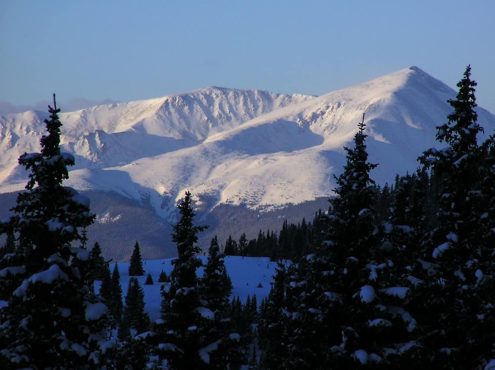
Alaska: Denali (20,310 feet/6,190 meters)
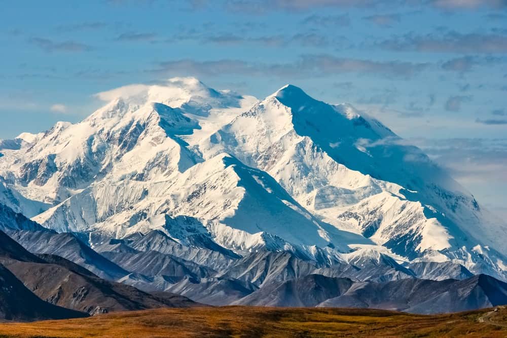
Denali, formerly known as Mount McKinley, is the highest peak in North America. Located in the heart of the Alaska Range, Denali is renowned not only for its altitude but also for its dramatic rise from base to peak. It has one of the largest vertical rises of any mountain situated entirely above sea level. This mountain is part of Denali National Park and Preserve, which is home to over six million acres of wild land. Climbing Denali is a intense challenge that attracts mountaineers from around the globe. The mountain’s name, which means “The Great One” in the native Koyukon language, perfectly encapsulates the presence of this giant.
Arizona: Humphreys Peak (12,633 feet/3,851 meters)
Humphreys Peak is Arizona’s highest point. This ancient stratovolcano, now dormant, is part of the San Francisco Peaks north of Flagstaff. It offers hikers a challenging ascent through diverse ecosystems—from alpine forests to arctic tundra at its summit. The peak is sacred to several Native American tribes, embodying spiritual significance and natural beauty. On clear days, the summit offers nice views from the Grand Canyon to the red rocks of Sedona. The Humphreys Peak Trail, leading to the summit, is a favorite among Arizona’s hiking community.
Arkansas: Magazine Mountain (2,753 feet/839 meters)

Magazine Mountain, also known as Mount Magazine, is Arkansas’s tallest peak. Situated in the Ozark National Forest, this mountain has breathtaking scenic vistas, lush hardwood forests, and unique alpine tundra. The mountain’s name is believed to derive from the French word “magasin,” meaning warehouse, likely referring to the mountain’s shape as a storehouse of natural beauty. The state park that encompasses the summit offers various recreational activities, from hiking and bird watching to rock climbing and hang gliding.
California: Mount Whitney (14,505 feet/4,421 meters)
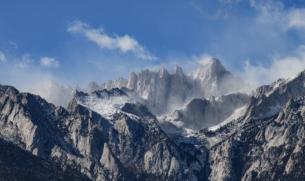
Mount Whitney is highest summit in the contiguous United States (lower 48 states). It is the most prominent feature of the Sierra Nevada range. Whitney is located on the boundary of Sequoia National Park and Inyo National Forest in California. The mountain attracts thousands of hikers and climbers each year, who take on the challenge of reaching its summit via the Whitney Trail. It’s done as a backpacking trip or as a long day hike (making it great training for Kilimanjaro’s summit day). Despite its elevation, Mount Whitney is accessible to well-prepared hikers, offering unparalleled views of the Sierra Nevada and the Owens Valley. The mountain’s ecosystem is a delicate alpine environment, home to a variety of flora and fauna adapted to high altitudes.
Connecticut: Mount Frissell (South Slope) (2,380 feet/725 meters)
Mount Frissell’s south slope is the highest point in Connecticut. It presents a unique geographical quirk as the actual summit lies just over the border in Massachusetts. The trail to Connecticut’s highest elevation winds through the Taconic Mountains. This area is characterized by dense forests, rocky outcrops, and vibrant fall foliage. The hike includes a visit to the tri-state marker, where Connecticut, Massachusetts, and New York meet. Despite its modest elevation, the hike to Connecticut’s highest point is a pleasant adventure that highlights the natural beauty of the Northeast.
Colorado: Mount Elbert (14,433 feet/4,399 meters)
Mount Elbert is Colorado’s highest peak and the second-highest peak in the continental United States. Located in the Sawatch Range, it is part of the Rocky Mountains. The peak is named after Samuel Hitt Elbert, a governor of the Territory of Colorado. It is known for its panoramic views that span the surrounding Rockies. Mount Elbert does not require technical climbing in summer, making it very accessible for all levels of hikers. The area around Mount Elbert is a haven for wildlife, including elk, mule deer, and a variety of bird species.
Delaware: Ebright Azimuth (448 feet/137 meters)
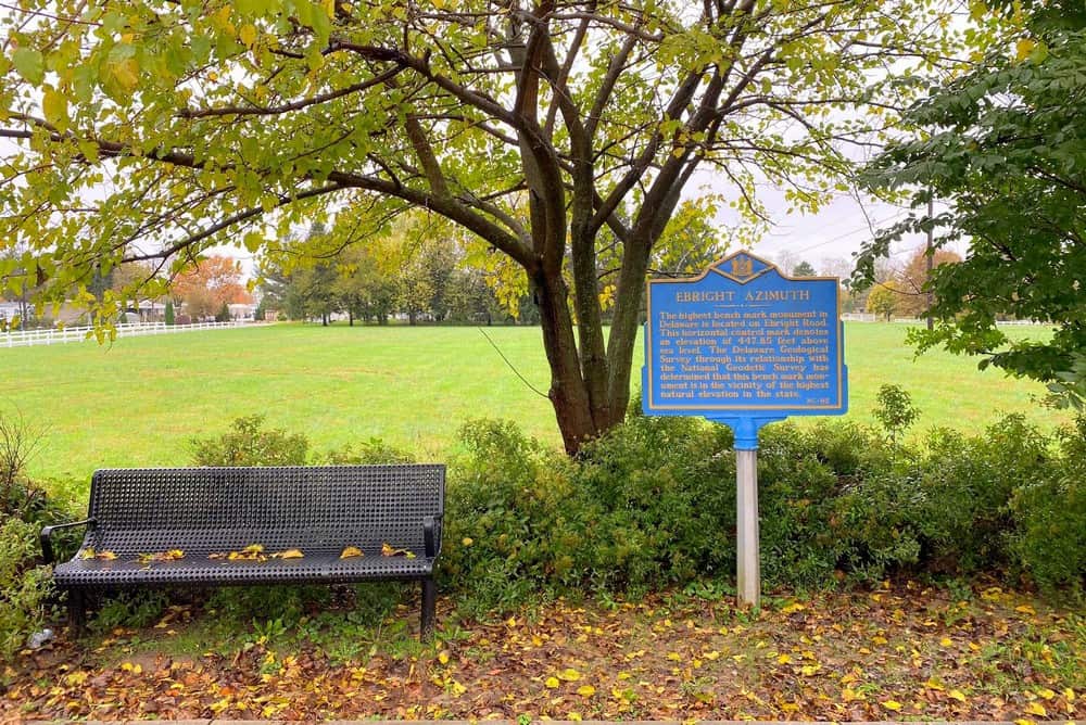
Ebright Azimuth is only 448 feet tall, so it may not offer the dramatic landscapes typical of America’s highest points. However, it still holds its own charm as Delaware’s pinnacle. Located in a suburban area near the Pennsylvania border, this high point is marked by a sign and benchmark on the side of a road, reflecting the state’s topographical subtlety. The area around Ebright Azimuth is representative of the gentle, rolling hills of the Brandywine Valley. It provides a fun entry for highpointers and those interested in geographic curiosities. The high point’s name honors James and Grant Ebright, on whose land the benchmark was originally placed.
Florida: Britton Hill (345 feet/105 meters)
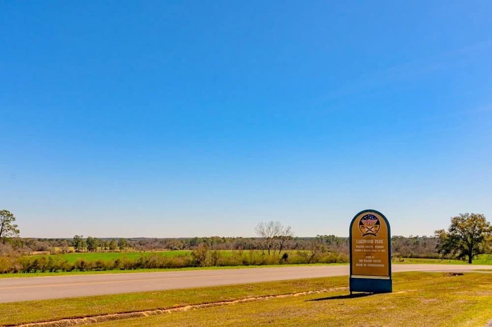
As the lowest “high point” in the United States, Britton Hill in Florida offers a different kind of summit experience. Located in Lakewood Park in Walton County, it doesn’t boast the alpine ecosystems or physical climbs of higher peaks, but it does provide a tranquil, green space in the Florida Panhandle. This gentle hill is illustrative of Florida’s subtropical beauty, surrounded by lush vegetation. It’s a peaceful spot to enjoy nature and a family-friendly destination.
Georgia: Brasstown Bald (4,784 feet/1,458 meters)
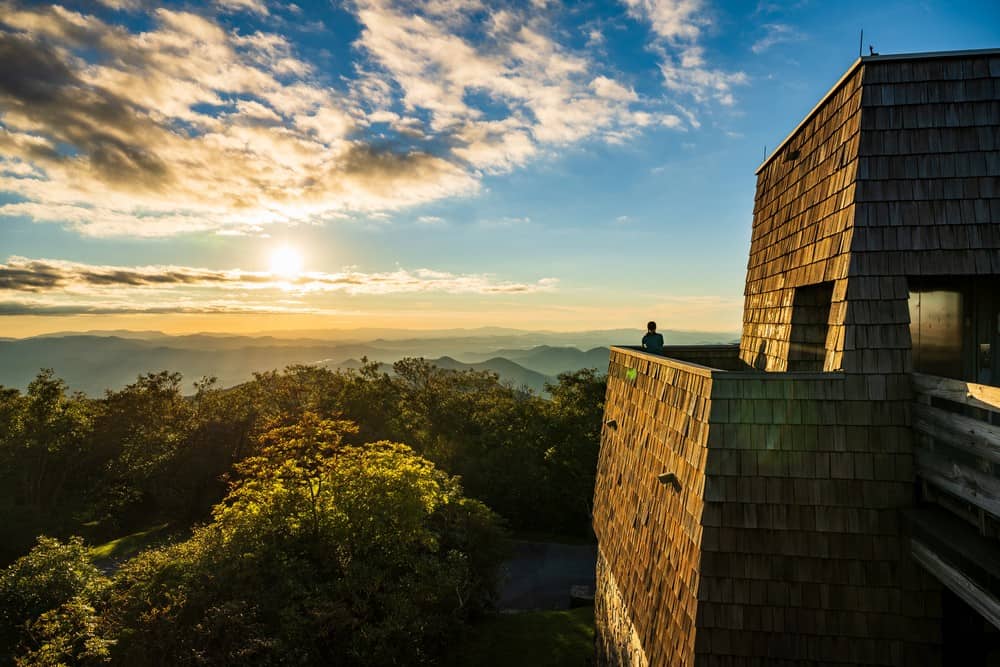
Brasstown Bald is Georgia’s highest peak. It offers sights that span four states on clear days. The mountain is part of the Blue Ridge Mountains, covered by dense forests and rich in biodiversity. An observation tower at the summit provides visitors with a 360-degree view of the surrounding Appalachian landscape. The area is accessible by a paved road and a short hike. Brasstown Bald also features a visitor center and museum, where guests can learn about the mountain’s ecology, geology, and history.
Hawaii: Mauna Kea (13,803 feet/4,207 meters)
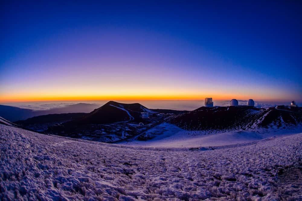
Mauna Kea is a dormant volcano on the Big Island of Hawaii. It’s not only the state’s highest point but also the tallest mountain in the world when measured from its base on the ocean floor. Its summit, often capped with snow, hosts the world’s largest astronomical observatory, taking advantage of the clear skies and minimal light pollution. The diverse climates from the base to rocky summit offer interesting habitats for endemic flora and fauna. The journey to the summit is accessible via road, making it possible for all visitors to experience the island from above the clouds. Native Hawaiians consider Mauna Kea a sacred place.
Idaho: Borah Peak (12,668 feet/3,861 meters)
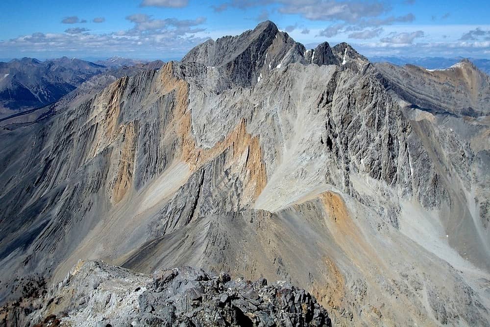
Borah Peak, also known as Mount Borah, is Idaho’s tallest mountain and part of the Lost River Range in the Rocky Mountains. The climb, known as “Chicken-Out Ridge,” is famed for its thrilling exposure and technical difficulty. The peak presents beautiful views of Idaho’s vast wilderness, with its sharp ridges and deep valleys carved by ancient glaciers. Borah Peak’s environment is home to a variety of wildlife, including mountain goats and elk.
Illinois: Charles Mound (1,235 feet/376 meters)
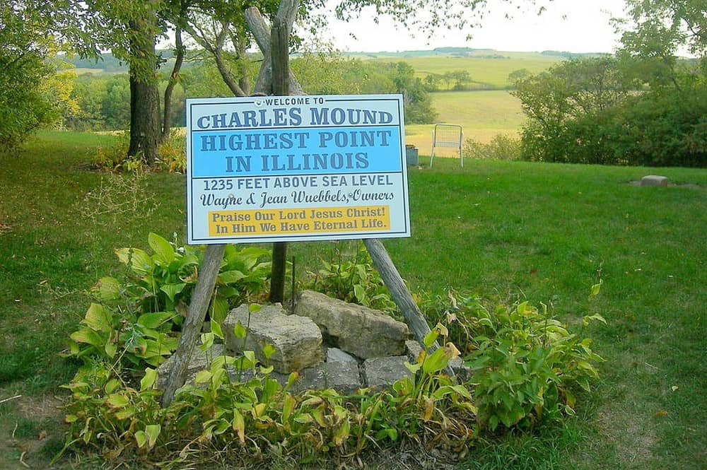
Charles Mound is Illinois’ highest point. As you might guess from the name, it offers a gentle, rolling landscape characteristic of the state’s driftless area. The feature is located on private property in the northwest corner of Illinois, near the town of Scales Mound. Visitors are allowed only on specific dates set by the landowners, making a visit to Charles Mound a special excursion. The summit area, surrounded by farmland and prairie, showcases the natural beauty of Illinois’ less urbanized regions. While the elevation gain is unimporessive, the views from the top do include wide stretches of the surrounding countryside.
Indiana: Hoosier High Point (1,257 feet/383 meters)
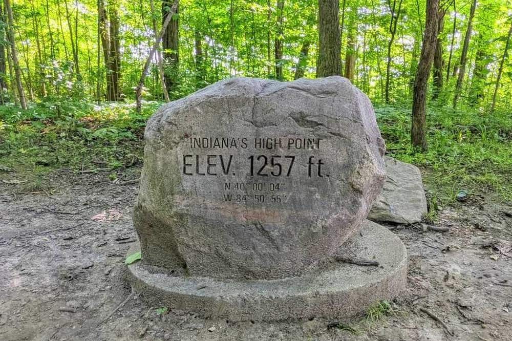
Hoosier High Point, also known as Hoosier Hill, is the highest point of Indiana. It is located in the rural landscape of Wayne County within a small, dedicated park. A modest monument marks the spot, surrounded by the farmlands and forests characteristic of east-central Indiana. Hoosier High Point includes a picnic area and a short trail, exemplifying the subtle beauty of the Midwest’s landscape.
Iowa: Hawkeye Point (1,670 feet/509 meters)
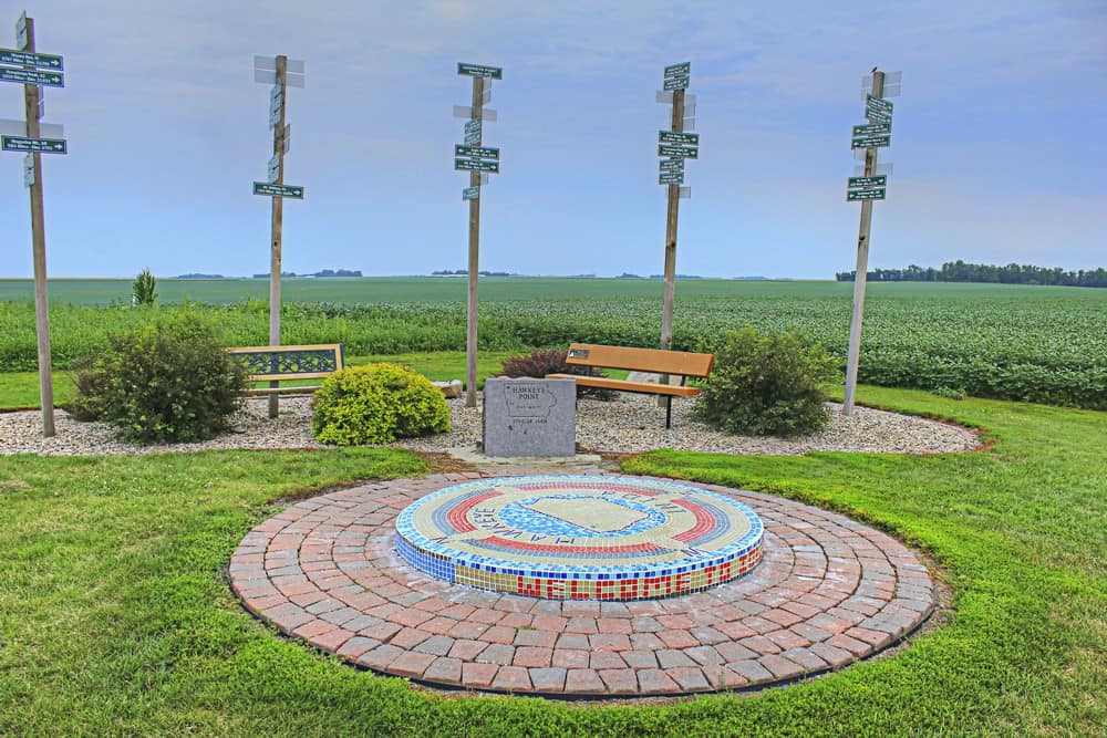
Hawkeye Point is the Iowa’s highest point. Located in the northwest corner of the state, Hawkeye Point is part of a vast agricultural landscape. The site has been developed to celebrate Iowa’s agricultural heritage, with informational displays and farm equipment exhibits. Visitors to Hawkeye Point can enjoy the easy views of surrounding fields and farmlands. Hawkeye Point’s charm lies in its simplicity and the connection it offers to Iowa’s farming community. It’s easily accessible, with markers and a platform to denote the point.
Kansas: Mount Sunflower (4,039 feet/1,231 meters)
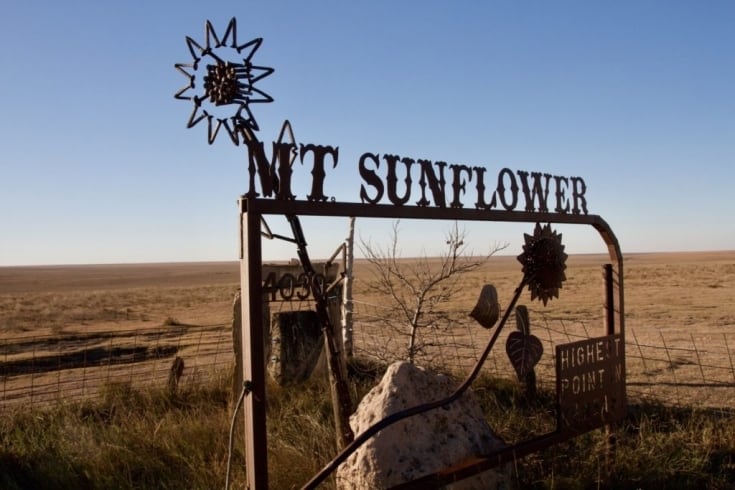
Mount Sunflower, despite its name, is not a mountain but the highest natural point in Kansas. This high point, located near the Colorado border, is situated on private farmland. Tourists are welcomed with a sunflower-shaped sign, benches, and a logbook to commemorate their visit. The landscape around Mount Sunflower features the rolling hills and wide-open skies characteristic of the American Great Plains. While the site may lack the dramatic elevation changes of traditional mountains, it offers a serene and picturesque setting that captures the spirit of Kansas.
Kentucky: Black Mountain (4,145 feet/1,263 meters)
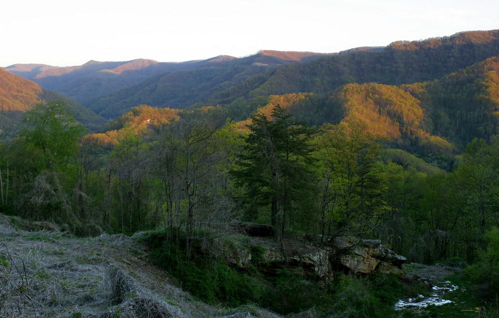
Black Mountain is the highest point in Kentucky. Situated near the Virginia border, this peak is part of the Cumberland Mountains. The summit area is accessible by vehicle, making it one of the more easily reachable high points. The mountain is a serene spot, largely untouched by heavy tourism. Black Mountain’s significance extends beyond its height; it is a symbol of the rich coal mining history of the region.
Louisiana: Driskill Mountain (535 feet/163 meters)
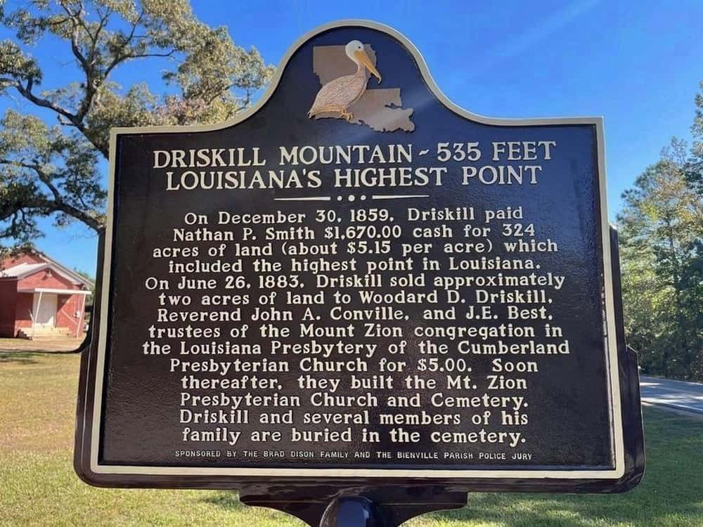
Driskill Mountain is the highest point in Louisiana. Located in the northern part of the state, within Bienville Parish, this gentle hill is more of a forested rise than a mountain. The summit can be reached via a short, well-marked trail that offers a nice walk through hardwood forests. Driskill Mountain’s modest elevation reflects the generally flat landscape of Louisiana but provides a memorable hiking experience in the state. The mountain is named after James Christopher Driskill, who purchased the surrounding land in 1859.
Maine: Mount Katahdin (5,269 feet/1,606 meters)
Mount Katahdin is Maine’s highest point. It is popular due to its position as the northern end of the famous Appalachian Trail. It’s name, given by the Penobscot Indians, means “The Greatest Mountain,” a fitting title for this rugged, imposing peak. Located in Baxter State Park, Katahdin is a haven for hikers and climbers. The mountain’s alpine environment supports a variety of wildlife and plant species that are adapted to its harsh, windy conditions. Katahdin is a symbol of wilderness conservation, thanks to Governor Percival Baxter’s efforts to preserve the area for future generations.
Maryland: Hoye Crest (3,360 feet/1,024 meters)
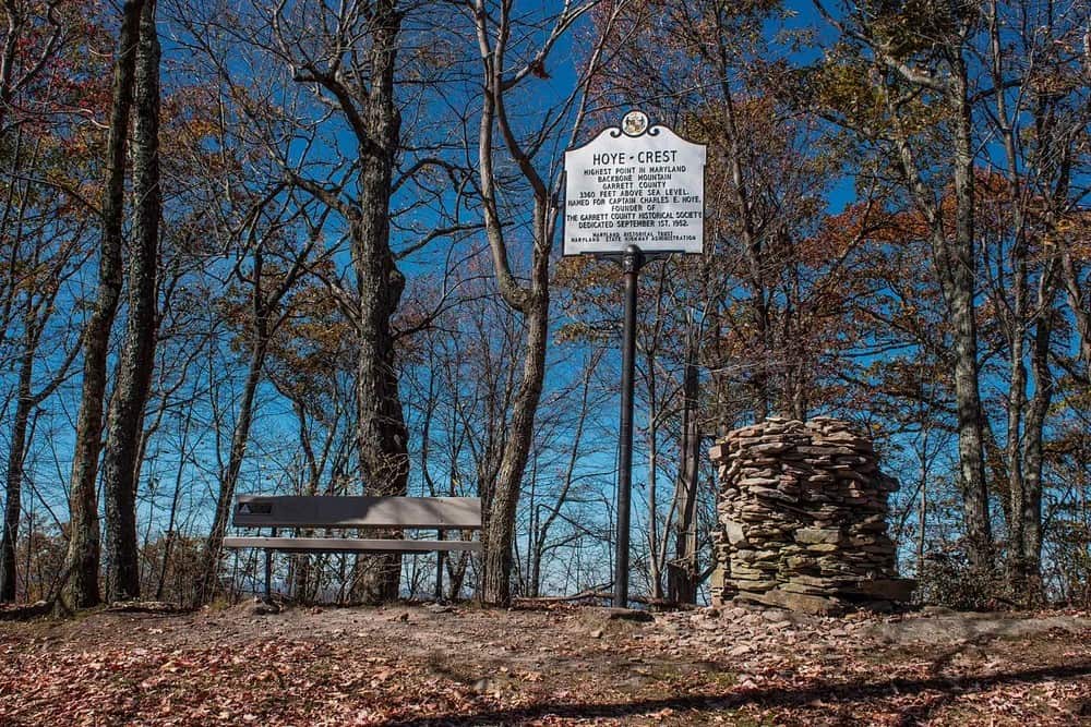
Hoye Crest, on Backbone Mountain, is Maryland’s highest point. Located near the West Virginia border, this summit offers hikers a moderate challenge through beautiful Appalachian forests. The trail to Hoye Crest begins in West Virginia. At the summit, a marker denotes the highest point. The area is part of the broader Garrett State Forest, offering numerous outdoor recreational opportunities.
Massachusetts: Mount Greylock (3,489 feet/1,063 meters)
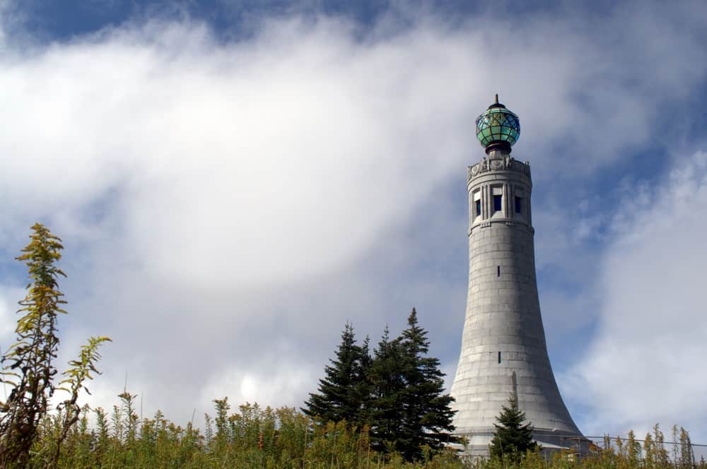
Mount Greylock is the highest point in Massachusetts. Located in the northwest corner of the state, it is part of a range that offers views of the surrounding Berkshire landscape. The mountain is notable for its historical War Memorial Tower, which pays tribute to the state’s fallen soldiers. The Appalachian Trail crosses over its summit, making Greylock a popular destination for hikers. In the winter, the mountain’s slopes are a draw for skiers and snowboarders.
Michigan: Mount Arvon (1,979 feet/603 meters)
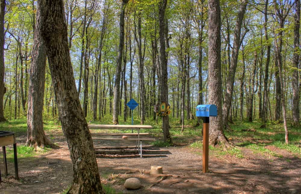
Mount Arvon is the highest point in Michigan. Located in the Upper Peninsula, this small peak is part of the Huron Mountains. It offers a quieter, more secluded experience than many of the country’s higher mountains. The journey to the summit passes through dense forests, and recent improvements have made the drive to the top more accessible. Visitors are greeted with a sign, a logbook to record their visit, and scenic views of Lake Superior and the surrounding forests. The area’s tranquility is perfect for those seeking solitude and a deep connection with nature.
Minnesota: Eagle Mountain (2,301 feet/701 meters)
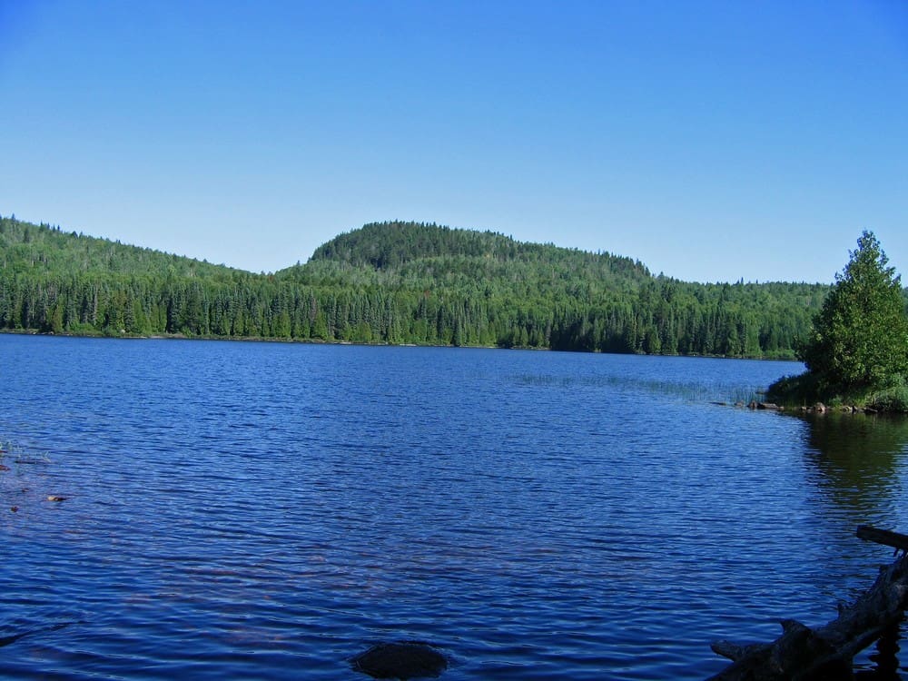
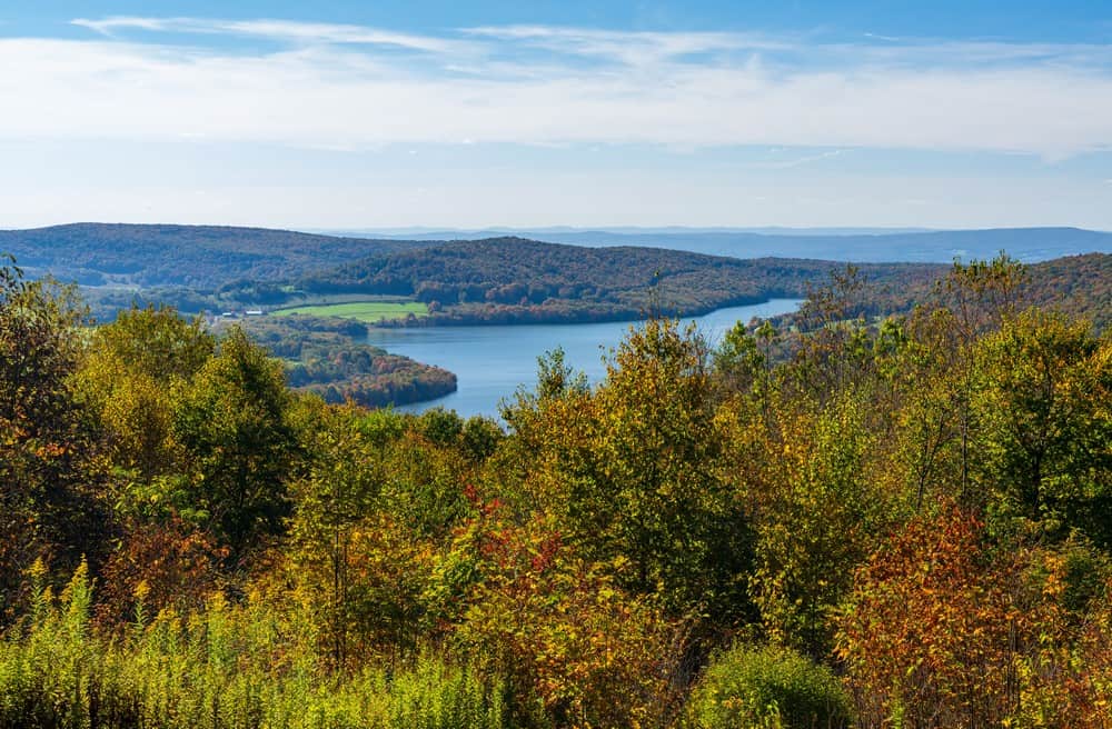
Eagle Mountain may not rival the Rockies or the Sierra Nevada in height, but as Minnesota’s highest point, it offers a beautiful, remote wilderness experience in the Boundary Waters Canoe Area Wilderness. The hike to the summit passes through dense forests and near pristine lakes, showcasing the natural beauty of the region. Eagle Mountain is only about 15 miles (24 km) from Minnesota’s lowest elevation, Lake Superior, at 600 feet (183 meters).
Mississippi: Woodall Mountain (806 feet/246 meters)
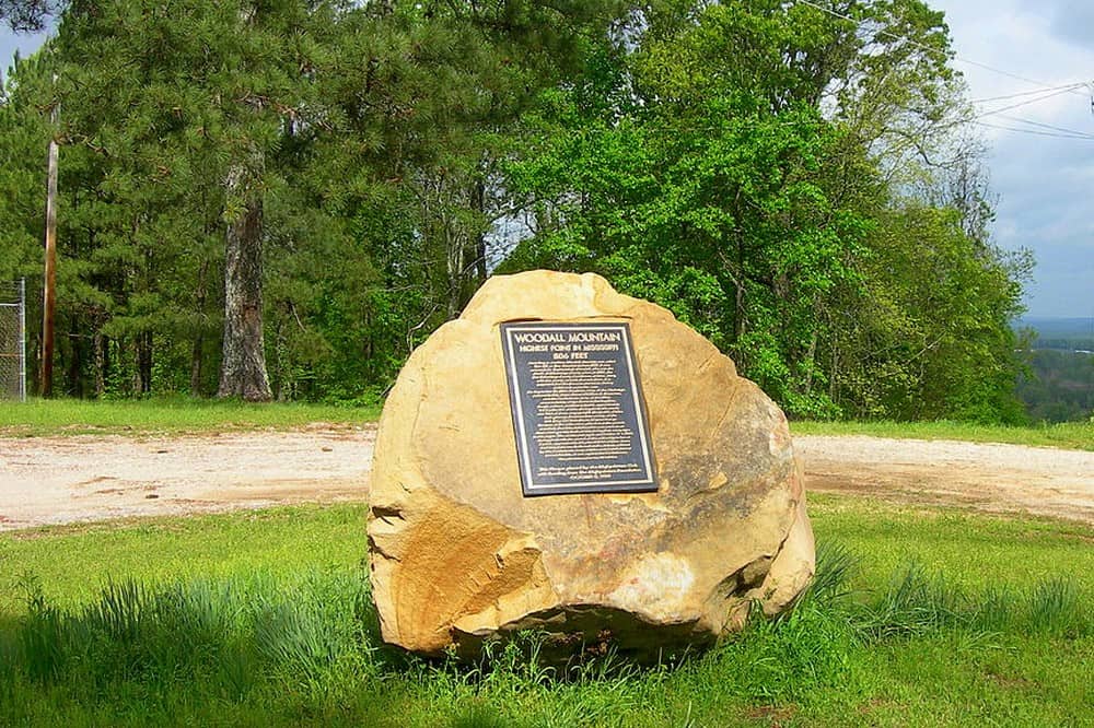
Woodall Mountain is the highest point in Mississippi. This low hill is located near the town of Iuka. A marker and a flagpole signify the high point, providing a photo opportunity for visitors. The area is remembered for its role in the Civil War; Woodall Mountain was the historic site of the Civil War’s Battle of Iuka in 1862. The mountain was initially named Yow Hill but was renamed in 1878 to honor Zephaniah Woodall, the sheriff of Tishomingo County at the time.
Missouri: Taum Sauk Mountain (1,772 feet/540 meters)
Taum Sauk Mountain is the highest point in Missouri. Part of the St. Francois Mountains, Taum Sauk is characterized by rugged terrain and scenic beauty. Its summit is located within Taum Sauk Mountain State Park. The park features Mina Sauk Falls, the state’s tallest waterfall, which is particularly impressive during the wet seasons. A portion of the Ozark Trail allows hikers to explore the area’s rich biodiversity and geological formations.
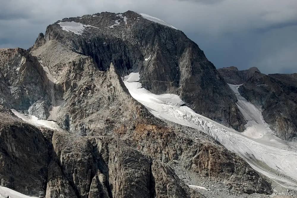
Montana: Granite Peak (12,799 feet/3,901 meters)
Granite Peak is the highest point in Montana. Situated in the Beartooth Mountains, it presents one of the most challenging climbs among the U.S. state highpoints. The hard terrain, unpredictable weather, and technical climbing sections make an ascent of Granite Peak a significant undertaking. Climbers are rewarded with awesome views of the surrounding wilderness, a pristine and untouched landscape that epitomizes the beauty of Montana. The area is home to a diverse array of wildlife, including mountain goats and bighorn sheep. Granite Peak is a premier climbing destination in the Northern Rockies.
Nevada: Boundary Peak (13,140 feet/4,005 meters)
Boundary Peak is Nevada’s highest summit. Named for its close proximity to the California border (less than half a mile or one kilometer), this mountain is part of the White Mountains range. The climb to the top is a trek through rough terrain, rewarding those who reach the summit with views of the Great Basin region. California’s Montgomery Peak (13,441 feet/4,097 meters) is just across the state line.
New Hampshire: Mount Washington (6,288 feet/1,917 meters)
Mount Washington is the highest point in New Hampshire. Located in the White Mountains, the mountain is a popular destination for hikers, climbers, and even drivers, with the Mount Washington Auto Road offering a quick route to the summit. The observatory at the peak famously recorded one of the highest wind speeds on Earth – 231 mph (372 kph). Mount Washington’s diverse ecosystems range from hardwood forests at its base to alpine tundra at the summit. The mountain also plays host to the historic Cog Railway.
New Jersey: High Point (1,803 feet/550 meters)
High Point is the highest point in New Jersey. Located in the northwestern part of the state, within High Point State Park, this peak offers views of the surrounding rural landscape, rich farmlands, and forests. The monument at the summit is dedicated to New Jersey’s veterans. The park’s trails, picnic areas, and facilities make it a popular destination for families and outdoorsy folk. In winter, the area transforms into a hotspot for snow sports.
New Mexico: Wheeler Peak (13,161 feet/4,011 meters)
Wheeler Peak is the highest point in New Mexico. It is located in the Sangre de Cristo Mountains, part of the Rocky Mountains. Wheeler Peak is home to diverse wildlife, including bighorn sheep and marmots, and offers opportunities for camping, fishing, and wildlife viewing. The summit provides excellent views of alpine forests and high desert landscapes that surround it.
New York: Mount Marcy (5,344 feet/1,629 meters)
Mount Marcy is the highest point in New York State. Located in the Adirondack Mountains, it’s a popular destination for hikers that culminates in panoramic views of the Adirondacks. Its possible to see the summits of 43 high peaks throughout the Adirondacks. And on clear days, even Mount Royal in Montreal is visible. The mountain is home to alpine tundra, a rare ecosystem for the region, and is the source of the Hudson River. The area was a training ground for Arctic explorers.
North Carolina: Mount Mitchell (6,684 feet/2,037 meters)
Mount Mitchell is the highest point east of the Mississippi River. It crowns the Black Mountains of North Carolina. The summit is accessible via a paved road and a short hike. The area around Mount Mitchell is a designated state park, offering trails, camping, and educational exhibits. The mountain is named after Elisha Mitchell, a professor who confirmed its height and tragically died exploring its slopes. In 1915, Mount Mitchell was established as North Carolina’s first state park.
North Dakota: White Butte (3,506 feet/1,069 meters)
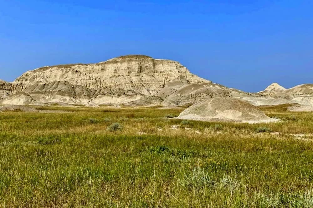
White Butte is the highest point in North Dakota. Located in the Badlands, this stark, white-topped butte contrasts dramatically with the surrounding grasslands. The butte is part of the Dakota Hogback formation, which consists of sedimentary rock that was deposited over 60 million years ago. The rock layers are tilted, giving the butte its distinctive shape. The hike to the summit is relatively short but offers a glimpse into the unique geological features of the Badlands, including fossilized remains.
Ohio: Campbell Hill (1,550 feet/472 meters)
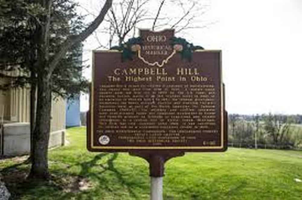
Campbell Hill is Ohio’s highest point. Located in Bellefontaine, this short peak is part of the gently rolling landscape that is indicative of the Midwest. The hill is situated on the campus of the Ohio Hi-Point Career Center. Despite its urban setting, Campbell Hill offers a different vantage point to appreciate Ohio’s agricultural heartland. It was named for Charles O. Campbell, who once owned the property.
Oklahoma: Black Mesa (4,973 feet/1,516 meters)
Black Mesa is the Oklahoma’s highest point. Located in the Oklahoma Panhandle, it derives its name from the layer of black lava rock that coats its surface. This flat-topped mesa is part of a larger geological formation that extends into New Mexico and Colorado. The area around Black Mesa is characterized by its stark, striking landscape. The mesa is home significant dinosaur fossils, making it a site of both natural and scientific interest. The views from the top stretch far into the surrounding states.
Oregon: Mount Hood (11,249 feet/3,429 meters)
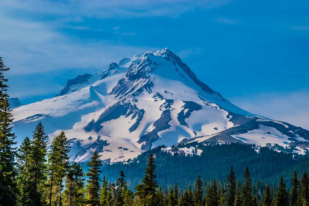
Mount Hood is the highest point in Oregon. Dominating the landscape east of Portland, this potentially active stratovolcano is a prominent landmark and a favorite destination for climbers and skiers. The mountain’s glaciers and snowfields provide year-round outdoor recreational opportunities, from downhill skiing to mountaineering. The Timberline Trail encircles the mountain, offering hikers varied scenery and diverse ecosystems. The historic Timberline Lodge, a National Historic Landmark, sits on its southern slope, providing visitors with a glimpse into the 1930s WPA era.
Pennsylvania: Mount Davis (3,213 feet/979 meters)
Mount Davis is the highest point in Pennsylvania. Located in the southwestern part of the state, within Forbes State Forest, this modest peak has a blend of natural beauty and geological diversity. An observation tower at the summit provides views of the surrounding Appalachian Plateau. The area around Mount Davis features a variety of hiking trails, picnic areas, and natural attractions, including massive boulders and wetlands. The mountain is named after John Nelson Davis, an early settler and naturalist who recognized the significance of preserving the area’s natural beauty.
Rhode Island: Jerimoth Hill (812 feet/247 meters)
Jerimoth Hill is the highest point in Rhode Island. It is situated in the northwestern part of the state, near the Connecticut border. The high point is located on private property but is accessible to the public during daylight hours, thanks to agreements with the landowners. The hill was named after Jerimoth Brown, an early settler. Visitors to Jerimoth Hill will find a serene, wooded area marked by a sign and a path leading to the summit.
South Carolina: Sassafras Mountain (3,554 feet/1,083 meters)
Sassafras Mountain is the highest point in South Carolina. The peak lies on the border between South Carolina and North Carolina, within the Appalachian Mountains. Recent improvements, including the construction of an observation tower, have enhanced the visitor experience, offering sweeping views of the Blue Ridge Mountains. The mountain is a key feature of the Foothills Trail, attracting hikers from across the region. Its name comes from the abundance of Sassafras trees on the mountain’s slopes.
South Dakota: Black Elk Peak (7,244 feet/2,208 meters)
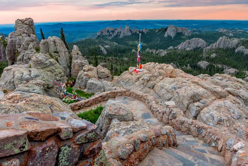
Black Elk Peak is the highest point in South Dakota. Located in the Black Hills, this summit was formerly known as Harney Peak and was renamed in honor of the Lakota spiritual leader Black Elk. The peak is accessible via several trails that offer varying levels of difficulty, winding through Custer State Park and the Black Elk Wilderness. An historic stone fire tower lies at the summit, built by the Civilian Conservation Corps. The area is sacred to many Native American tribes and is rich in cultural and natural history.
Tennessee: Clingmans Dome (6,643 feet/2,025 meters)
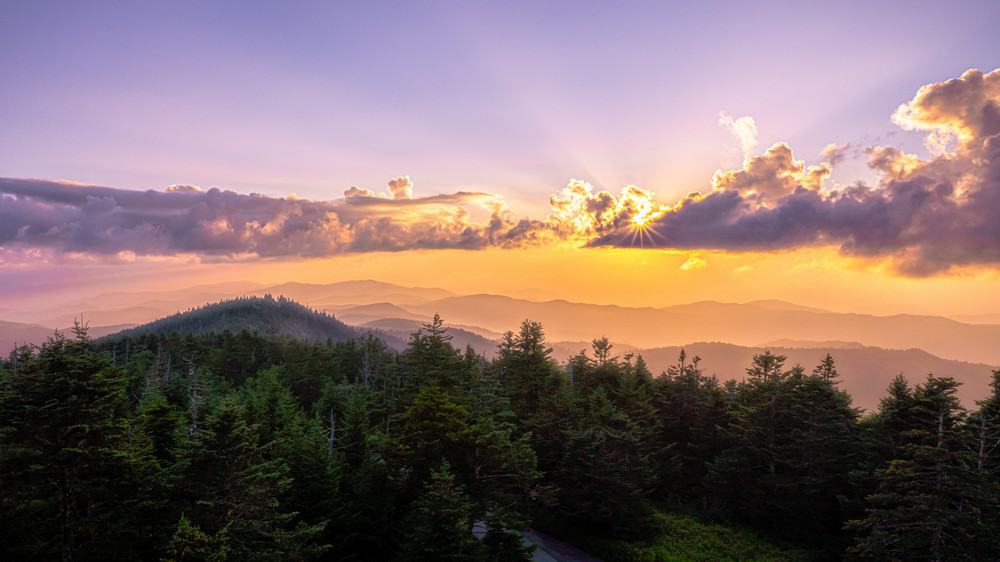
Clingmans Dome is the highest point in Tennessee and is located within the Great Smoky Mountains National Park. This mountain straddles the border between Tennessee and North Carolina and is part of the Appalachian Trail. The summit is accessible via a paved path, leading to an observation tower that offers 360-degree views of the smokies, rolling hills, and valleys. The area around Clingmans Dome features a diverse range of ecosystems, from spruce-fir forests to deciduous woodlands, supporting a wide variety of wildlife. The mountain’s elevation makes it one of the best places in the park to view the famous “smoky” fog that gives the region its name.
Texas: Guadalupe Peak (8,751 feet/2,667 meters)
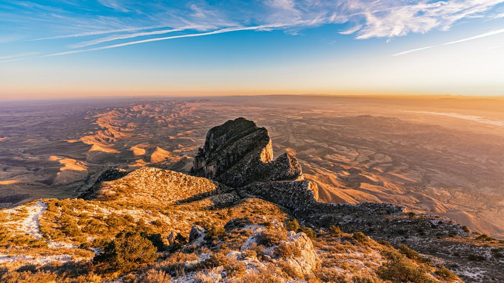
Guadalupe Peak is the highest point in Texas. It stands high over the Chihuahuan Desert. Located in Guadalupe Mountains National Park, this limestone peak offers hikers views of the surrounding desert landscape. The trail to the summit journeys through a diverse ecosystem, featuring high desert, woodland, and alpine environments. Known as the “Top of Texas,” the summit is marked by a stainless steel pyramid that was erected to commemorate Butterfield Overland Mail, a transcontinental stagecoach route that passed south of the mountain.
Utah: Kings Peak (13,528 feet/4,123 meters)
Utah’s highest point is Kings Peak. It lies in the Uinta Mountains and offers one of the most remote wilderness experiences in the continental United States. The hike to Kings Peak is demanding, traversing jagged terrain and vast alpine basins. This peak attracts serious hikers and mountaineers looking to immerse themselves in Utah’s natural beauty. From the summit, hundreds of lakes and extensive alpine tundra can be seen. Kings Peak is named after Clarence King, the first director of the U.S. Geological Survey.
Vermont: Mount Mansfield (4,395 feet/1,340 meters)
Mount Mansfield is the highest point in Vermont. This mountain resembles the profile of a human face when viewed from the east, complete with a forehead, nose, lips, and chin, with the “chin” being the highest point. Located within the Green Mountains, Mount Mansfield is one of the few spots in Vermont where true alpine tundra survives from the Ice Ages. The summit is accessible via hiking trails in the summer and ski lifts in the winter, making it a year-round attraction.
Virginia: Mount Rogers (5,729 feet/1,746 meters)
Mount Rogers is Virginia’s highest point, located in the Appalachian Mountains. Unlike many high peaks, the summit of Mount Rogers is noted for its dense spruce-fir forest, more reminiscent of Canada than Virginia. The surrounding area, part of the Mount Rogers National Recreation Area, offers a network of trails, including a section of the Appalachian Trail. The region is home to wild ponies, which roam freely and add a magical element to the landscape.
Washington: Mount Rainier (14,411 feet/4,392 meters)
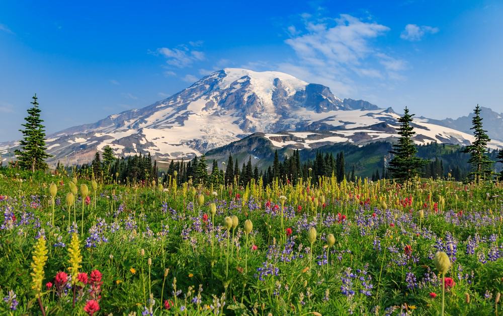
Mount Rainier is the highest point in Washington state. It is an iconic symbol that dominates the landscape with its snow-capped peak and glaciated terrain. As an active stratovolcano, Rainier presents a worthy challenge to climbers, with its dynamic weather, crevasse-laden glaciers, and potential for volcanic activity. The wildflower meadows that ring the mountain in summer are legendary, offering a colorful contrast to the icy peak above. Rainier’s ecosystem supports a rich array of wildlife, including black bears, mountain goats, and the elusive pika. Scaling Mount Rainier requires preparation and respect for the mountain’s power, but it is a achievable goal for new alpine climbers.
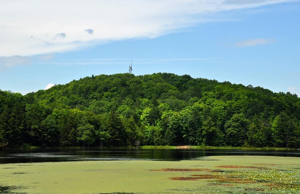
West Virginia: Spruce Knob (4,863 feet/1,482 meters)
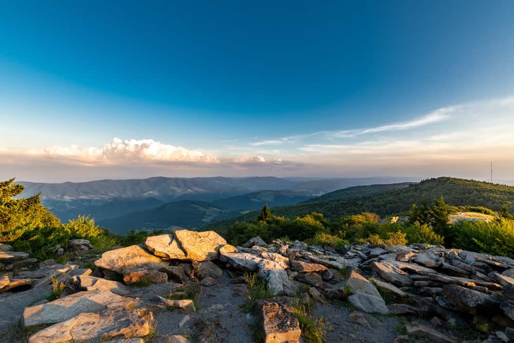
Spruce Knob is West Virginia’s highest peak, offering sweeping views of the Allegheny Mountains. Part of the Monongahela National Forest, this mountain is celebrated for its rugged landscape, dense spruce forests, and clear night skies. The area’s extensive trail system, including the Whispering Spruce Trail, provides easy access to breathtaking overlooks. Spruce Knob Tower, a stone and steel observation tower, is a great vantage point to enjoy a 360 degree view.
Wisconsin: Timms Hill (1,951 feet/595 meters)
Timms Hill is Wisconsin’s highest point. Located in Timms Hill County Park, this peak is surrounded by a mosaic of glacial hills, clear waters, and dense woodlands. The park’s trails connect to the Ice Age National Scenic Trail, linking Timms Hill to a broader landscape shaped by glacial forces. If you climb its observation tower, you’ll be rewarded with a 30-mile view of the vast Northwoods and perhaps catch a glimpse of its resident bald eagles.
Wyoming: Gannett Peak (13,804 feet/4,207 meters)
Gannett Peak is the highest point in Wyoming. It sits within the Wind River Range. The journey to Gannett Peak involves days of navigating its challenging trails, river crossings, and extensive glaciers. The peak is celebrated for its pristine alpine environment, with crystal-clear lakes and ice fields. Gannett Glacier is the largest single glacier in the Rocky Mountains. The area’s isolation preserves its wilderness character, making a trek to Gannett Peak a true adventure.


")
")


")

")