


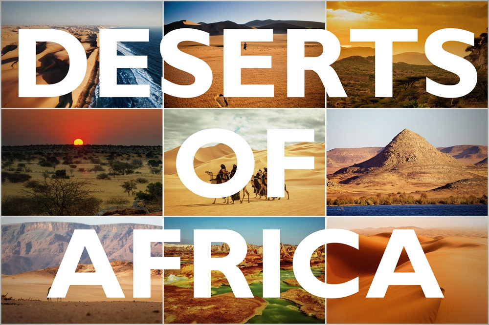
Africa has the most named deserts of any continent, containing at least ten distinct deserts. These deserts cover about one third of the continent’s land area and come in many forms. From scorching sand seas to salt flats, they define much of the landscape. To understand Africa, you need to understand its deserts.
Why Does Africa Have So Many Deserts?
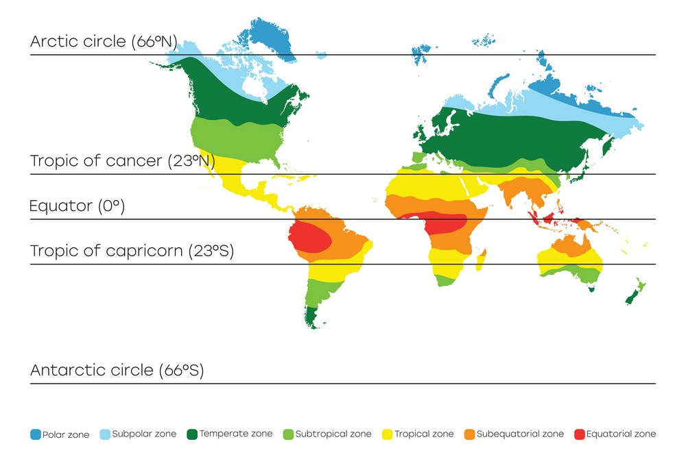
Most of Africa’s deserts sit near the Tropic of Cancer or Tropic of Capricorn. These zones fall under a global wind pattern that suppresses rainfall. Dry air descends in these regions, warming as it sinks. That prevents cloud formation and blocks precipitation. Over time, this leads to arid and semi-arid conditions.
Africa is also shaped by vast plateaus and inland basins that trap heat. With few mountain ranges to block or redirect air currents, hot, dry winds dominate. These conditions are intensified by the Hadley Cell circulation pattern. This drives dry air from the equator toward the subtropics, reinforcing desert zones on both sides of the continent.
The 10 Deserts of Africa
| Desert | Countries | Area (sq mi) | Area (sq km) |
|---|---|---|---|
| Sahara Desert | Algeria, Chad, Egypt, Libya, Mali, Mauritania, Morocco, Niger, Sudan, Tunisia, Western Sahara | 3,600,000 | 9,300,000 |
| Kalahari Desert | Botswana, Namibia, South Africa | 350,000 | 900,000 |
| Namib Desert | Namibia, Angola, South Africa | 31,000 | 80,000 |
| Danakil Desert | Ethiopia, Eritrea, Djibouti | 5,100 | 13,200 |
| Libyan Desert | Libya, Egypt, Sudan | 420,000 | 1,087,000 |
| Nubian Desert | Sudan, Egypt | 154,000 | 398,000 |
| Ogaden Desert | Ethiopia, Somalia | 77,000 | 200,000 |
| Chalbi Desert | Kenya | 38,000 | 98,000 |
| Karoo Desert | South Africa | 154,000 | 398,000 |
| Ténéré Desert | Niger, Chad | 154,000 | 400,000 |
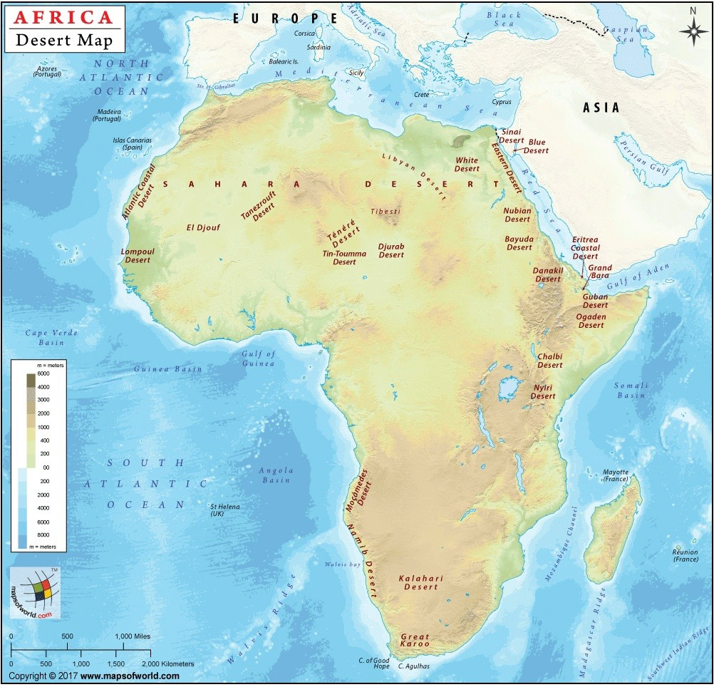
African Deserts
1. Sahara Desert
- Countries: Algeria, Chad, Egypt, Libya, Mali, Mauritania, Morocco, Niger, Sudan, Tunisia, Western Sahara
- Area: 3,600,000 sq mi (9,300,000 sq km)
- Temperature Range: 25–120°F (–4–49°C)
- Rainfall: Less than 3 in (<7.5 cm) per year
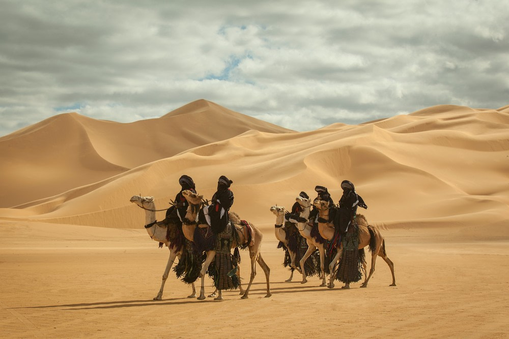
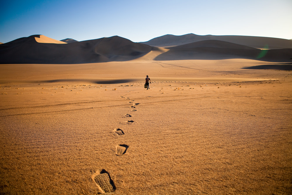
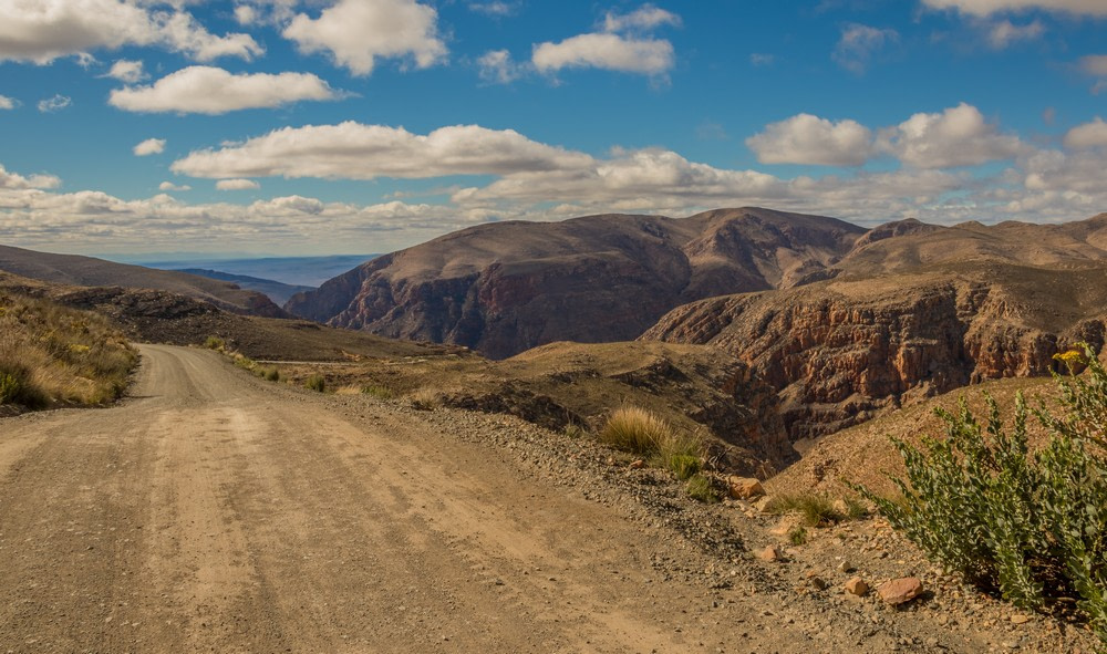
The Sahara is the largest hot desert in the world. It stretches across eleven countries from the Atlantic Ocean in the west to the Red Sea in the east, dominating North Africa with its sweeping sand dunes, gravel plains, and rocky plateaus.
Temperatures regularly soar above 115°F (46°C). Rain is scarce. Yet the Sahara is not lifeless. It supports hardy plants, desert foxes, and reptiles. Oasis towns and nomadic tribes like the Tuareg and Bedouin have survived here for centuries. Ancient trade routes once linked Saharan outposts to Mediterranean markets, moving salt, gold, and slaves across the dunes.
2. Kalahari Desert
- Countries: Botswana, Namibia, South Africa
- Area: 350,000 sq mi (900,000 sq km)
- Temperature Range: 32–113°F (0–45°C)
- Rainfall: 5–10 in (12–25 cm) per year
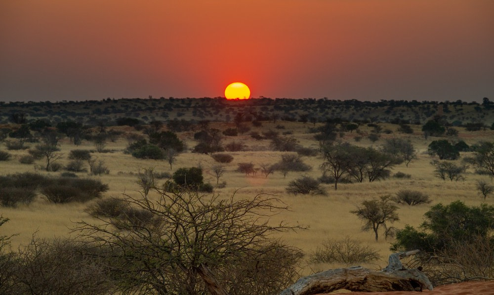
The Kalahari spans Botswana, Namibia, and South Africa. Unlike the Sahara, it’s technically a semi-desert. It receives more rainfall and supports more vegetation, including grasses, shrubs, and even trees.
The Kalahari is home to the San people, one of the world’s oldest continuous cultures. Wildlife includes meerkats, springbok, cheetahs, and lions. Red sand and flat plains define the landscape. Seasonal rains bring bursts of green and attract large game. The Okavango Delta, located on the desert’s edge, floods annually and creates a rich ecosystem.
3. Namib Desert
- Countries: Namibia, Angola, South Africa
- Area: 31,000 sq mi (80,000 sq km)
- Temperature Range: 50–113°F (10–45°C)
- Rainfall: 0.4–2 in (1–5 cm) per year
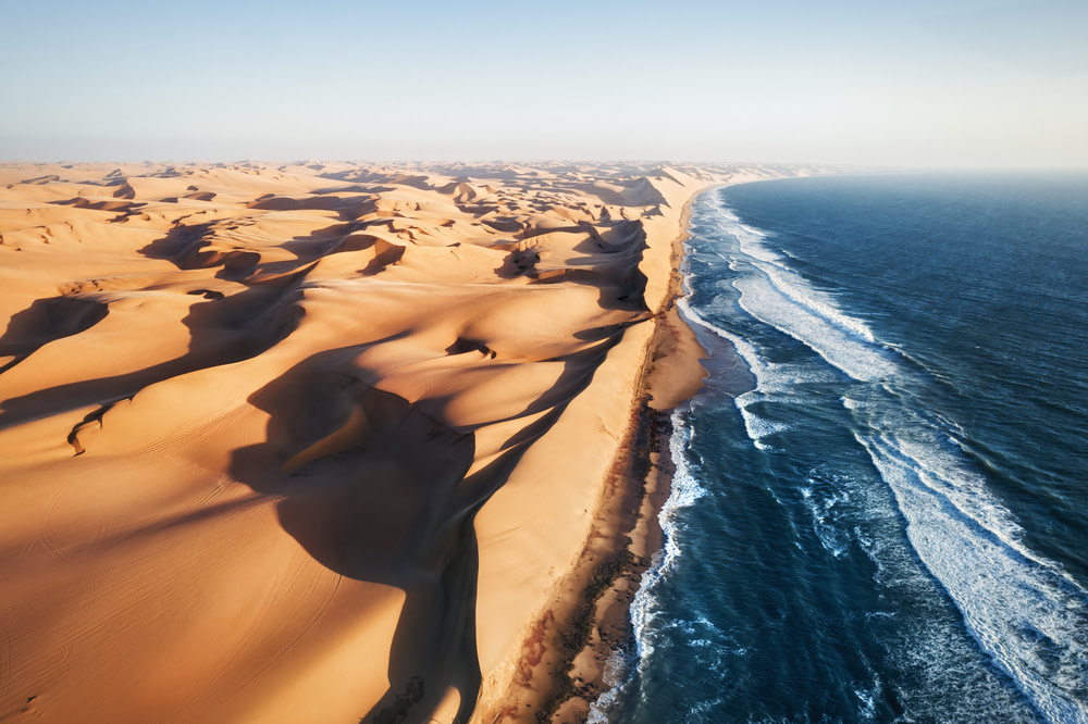
The Namib stretches along Namibia’s Atlantic coast for over 1,200 miles (2,000 kilometers). It is one of the oldest deserts on Earth, with parts dating back 55 million years. Its iconic red dunes and stark coastlines create a haunting, beautiful landscape.
The Namib supports desert-adapted elephants, oryx, and geckos. Fog from the ocean provides critical moisture. Shipwrecks dot the Skeleton Coast, where strong currents and shifting sands have doomed countless vessels. The sand dunes near Sossusvlei are among the tallest in the world, some reaching nearly 1,000 feet (300 meters).
4. Danakil Desert
- Countries: Ethiopia, Eritrea, Djibouti
- Area: 5,100 sq mi (13,200 sq km)
- Temperature Range: 77–122°F (25–50°C)
- Rainfall: 4–8 in (10–20 cm) per year
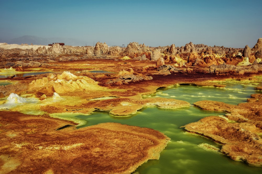
Located in northeastern Ethiopia, the Danakil is one of the hottest and most inhospitable places on the planet. Temperatures often exceed 120°F (49°C). The landscape includes salt flats, lava fields, and sulfur springs. Volcanic activity and shifting tectonic plates make it geologically active and visually surreal.
The Afar people mine salt here by hand, cutting it into slabs and transporting it by camel caravan. The desert is also home to Erta Ale, one of the few volcanoes with a permanent lava lake. The Danakil’s alien terrain attracts researchers and adventurers but is no place for the unprepared.
5. Libyan Desert
- Countries: Libya, Egypt, Sudan
- Area: 420,000 sq mi (1,087,000 sq km)
- Temperature Range: 30–120°F (–1–49°C)
- Rainfall: Less than 1.5 in (<4 cm) per year
Part of the greater Sahara, the Libyan Desert lies mostly in Libya but extends into Egypt and Sudan. It’s one of the driest places on Earth. Some areas go decades without measurable rainfall. Sand seas and barren rock define the landscape.
It is largely uninhabited, but scattered oases allow for small-scale farming and settlement. The harsh conditions have preserved ancient petroglyphs and ruins. Oil and gas exploration has brought some infrastructure to the region, but much of the desert remains untouched.
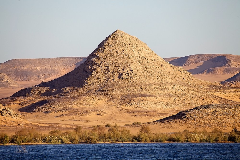
6. Nubian Desert
- Countries: Sudan, Egypt
- Area: 154,000 sq mi (398,000 sq km)
- Temperature Range: 45–113°F (7–45°C)
- Rainfall: 0.5–2 in (1–5 cm) per year
Located in northeastern Sudan and southern Egypt, the Nubian Desert is a rocky extension of the Sahara. It lies between the Nile River and the Red Sea. The region gets minimal rainfall and is characterized by rugged terrain rather than vast sand dunes.
Historically, it was part of ancient Nubia, a powerful African civilization that traded gold, ivory, and cattle. Today, few people live in the interior, but the desert remains important for archaeology and trans-Saharan transport routes.
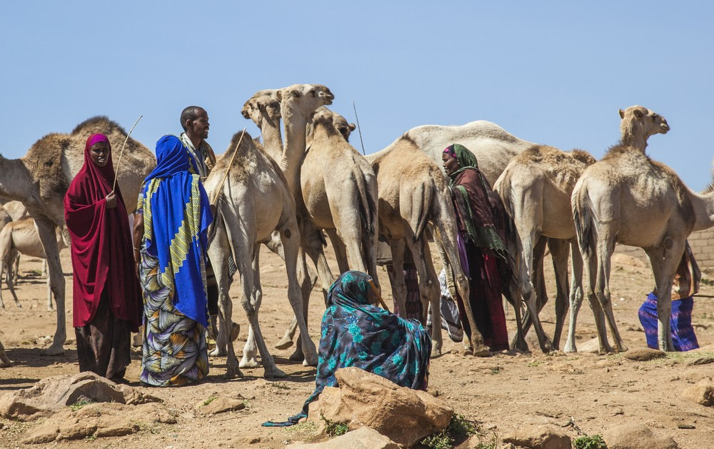
7. Ogaden Desert
- Countries: Ethiopia, Somalia
- Area: Approximately 77,000 sq mi (200,000 sq km)
- Temperature Range: 70–110°F (21–43°C)
- Rainfall: 4–10 in (10–25 cm) per year
Located in eastern Ethiopia and parts of northern Somalia, the Ogaden Desert is a dry, rugged region dominated by scrubland and sparse vegetation. It lies within the Somali Region of Ethiopia, an area marked by political tensions and limited infrastructure.
The desert supports nomadic pastoralists who herd camels, goats, and sheep. The region has long been underdeveloped, with few paved roads and little access to healthcare or education. Despite this, the Ogaden is known for its strategic location and natural gas reserves, which remain largely untapped.
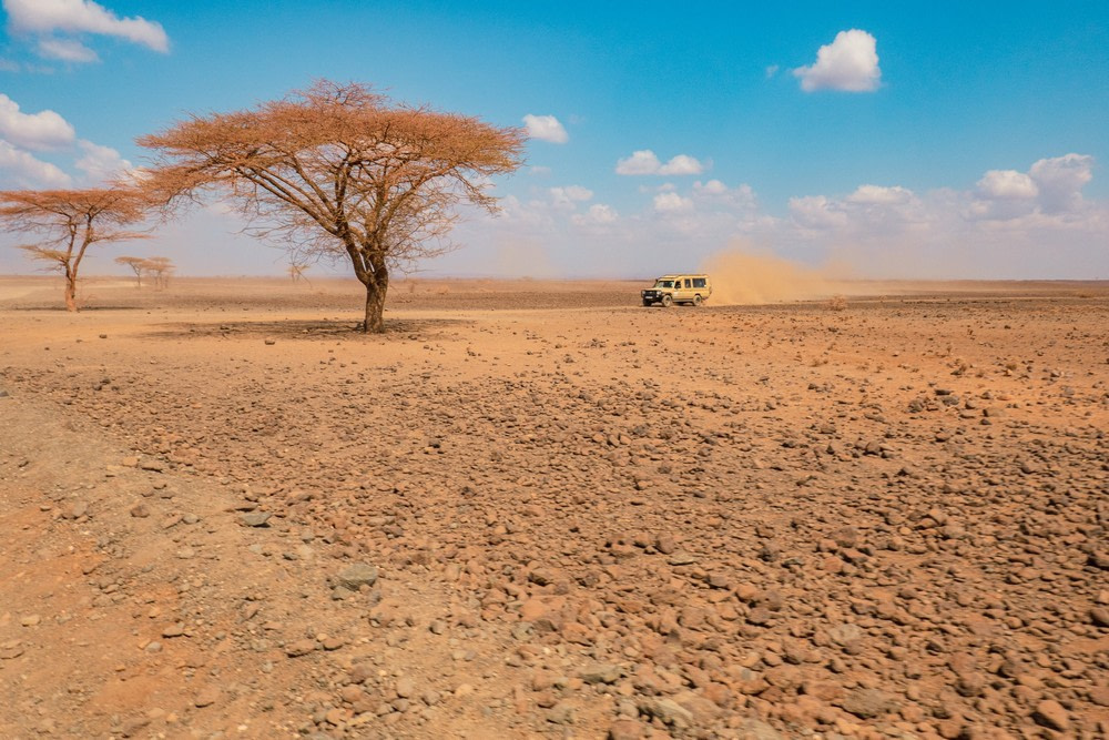
8. Chalbi Desert
- Country: Kenya
- Area: Approximately 38,000 sq mi (98,000 sq km)
- Temperature Range: 65–104°F (18–40°C)
- Rainfall: 2–8 in (5–20 cm) per year
The Chalbi Desert is located in northern Kenya, near the Ethiopian border. It is one of Kenya’s driest regions. The name “Chalbi” means “bare and salty” in the local Gabbra language. True to its name, the desert consists of salty pans, volcanic hills, and scattered sand dunes.
Nomadic communities like the Rendille and Gabbra have adapted by herding camels and goats. During rare rains, the salt flat turns into a temporary lake. The desert is also home to rare wildlife and attracts photographers.
9. Karoo Desert
- Country: South Africa
- Area: Approximately 154,000 sq mi (398,000 sq km)
- Temperature Range: 30–104°F (–1–40°C)
- Rainfall: 4–12 in (10–30 cm) per year
The Karoo is a semi-desert region in South Africa, divided into the Great Karoo and Little Karoo. It is not a true desert but has long dry seasons, hardy vegetation, and wide open plains. The Karoo is known for its unique biodiversity, including succulent plants and rare reptiles.
Historically, the Karoo has been used for sheep farming. In recent years, it has become a site for astronomical research, including the Square Kilometre Array (SKA) project. The region’s clear skies and isolation make it ideal for observing the universe.
10. Ténéré Desert
- Countries: Niger, Chad
- Area: Approximately 154,000 sq mi (400,000 sq km)
- Temperature Range: 40–115°F (4–46°C)
- Rainfall: Less than 0.8 in (2 cm) per year
The Ténéré is a vast expanse of sand in the heart of the Sahara. It lies mostly in Niger, stretching into eastern Chad. Known as the “desert within a desert,” it is one of the most desolate places on Earth. The name Ténéré comes from the Tuareg word for “desert.” In many parts of the region, there is nothing but sand for hundreds of miles.
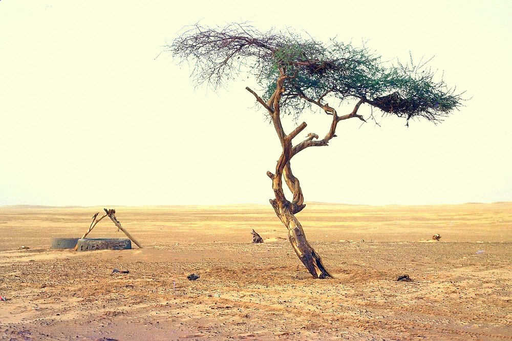
Once part of an ancient trade route, the Ténéré is scattered with fossils, stone tools, and caravan markers. The area is still crossed by nomads, though few people live there permanently. The desert gained notoriety for the Arbre du Ténéré, once considered the most isolated tree on Earth, standing alone for over 250 miles (400 kilometers) until it was accidentally struck down by a truck in 1973.

