


Where is Mount Whitney Located?
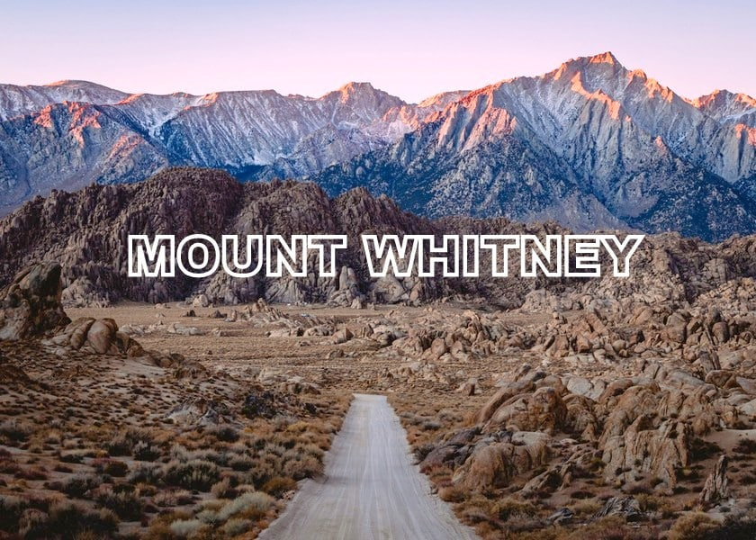
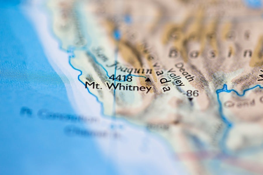
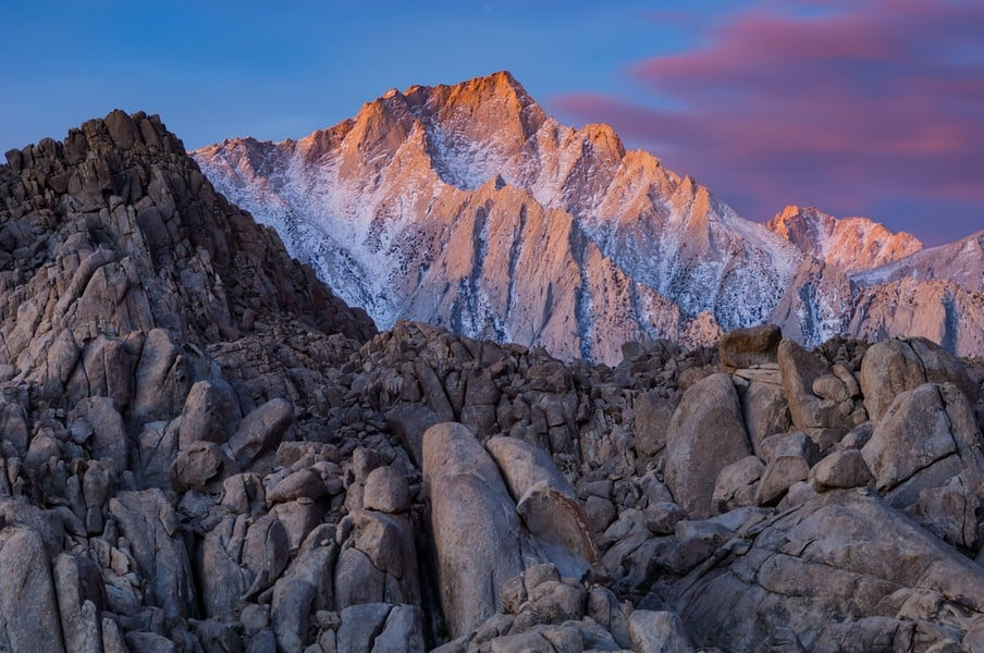
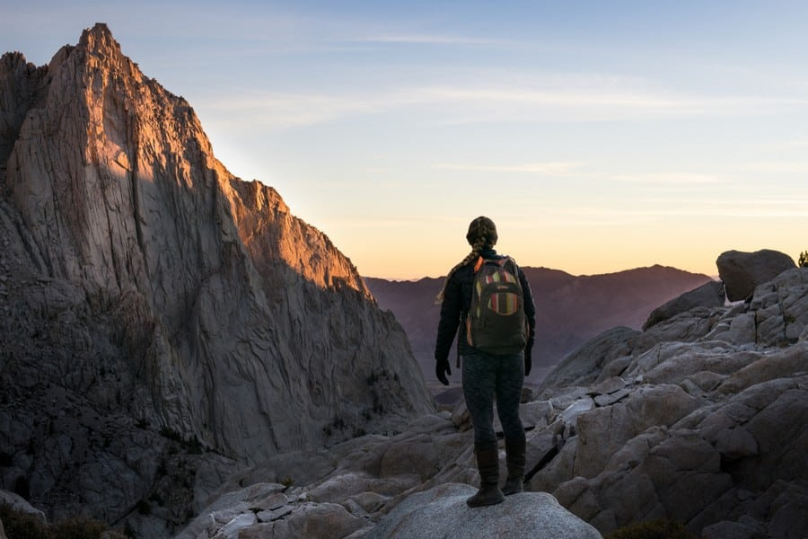
Mount Whitney is located in eastern California, inside the Inyo National Forest and on the boundary of Sequoia National Park. It rises from the Sierra Nevada Range, just west of Lone Pine. The summit lies 85 miles (137 km) west of Death Valley and about 230 miles (370 km) north of Los Angeles.
How Tall is Mount Whitney?
Mount Whitney is 14,505 feet (4,421 m) tall. It is the tallest mountain in the contiguous United States. Only peaks in Alaska, like Denali, stand higher in the U.S.
How Was it Formed?
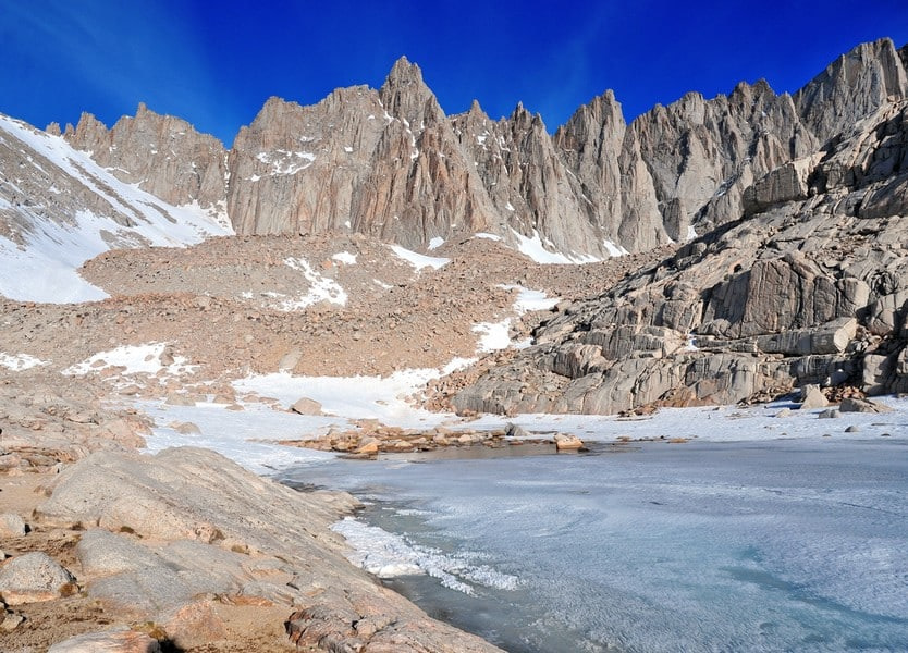
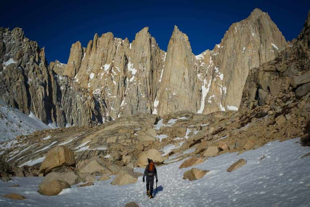
Mount Whitney is a fault-block mountain made of granite. It was shaped by uplift and erosion rather than volcanism. Around 100 million years ago, magma cooled slowly beneath the Earth’s crust, forming the Sierra Nevada batholith. Over time, uplift exposed the hard granitic rock. Ice age glaciers carved cirques and steepened the eastern escarpment. Wind, water, and freeze-thaw cycles sculpted its spires, towers, and cliffs.
What Does the Name Mean?
Mount Whitney was named after Josiah Whitney, California’s state geologist in the 1860s. He led early surveys of the Sierra Nevada and believed the unnamed summit was the tallest in the region.
The Paiute people, who lived in the region, referred to the peak as Tumanguya, often interpreted as “the very old man.” The name reflects the mountain’s spiritual importance and ancient appearance.
How Long Does it Take to Climb?
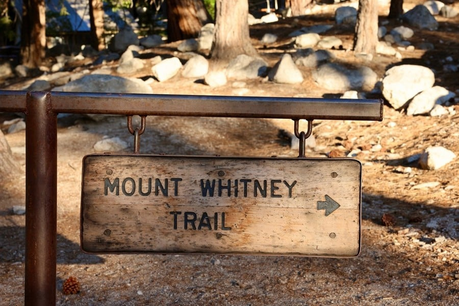
Most people climb Mount Whitney in one to three days using the Mount Whitney Trail. The full round trip covers 22 miles (35 km) with over 6,100 feet (1,859 m) of elevation gain.
Single-day climbs usually take 10 to 18 hours. Two-day trips break it into a hike to Trail Camp or Outpost Camp on day one and a summit bid early the next morning. Three-day trips are less common but provide extra rest and acclimatization.
How Hard is it to Climb Whitney?
Mount Whitney is not technical by the standard trail, but the length, altitude, and exposure make it strenuous. Most people underestimate how hard it is, especially as a day hike (it’s harder than summit day on Kilimanjaro).
The main challenges are distance, elevation gain, altitude, and weather. Summit day involves a steep, switchback-heavy climb, followed by a long traverse to the summit and a full descent the same day.
Even fit hikers can experience headaches, nausea, or fatigue from altitude.
What is the Success Rate on Whitney?
Success rates vary by season and route, but estimates for the main trail hover around 60–70%. Altitude issues, poor conditioning, late starts, and dehydration are the main reasons for failure. Weather and snow conditions also shut down climbs, especially in spring or fall.
Can Beginners Climb Whitney?
Yes, with proper preparation. Many first-time high-altitude hikers summit Whitney each year. But success depends on pacing, fitness, and understanding the effects of altitude.
Beginners should train for long days with significant uphill hiking. Acclimatization is critical. Spending a night at Horseshoe Meadow (10,000 feet/3,048 m) or Trail Camp (12,000 feet/3,658 m) helps the body adjust. Carrying enough food, water, and weather layers is mandatory. Rushing the climb or skipping training is a common mistake.
Who First Climbed Mount Whitney?
The first recorded ascent was on August 18, 1873, by Charles Begole, John Lucas, and Albert Johnson. These fishermen from Lone Pine followed a route up the north slope, likely near today’s Mountaineer’s Route.
Whitney’s summit was briefly misidentified during early surveys. Clarence King, a noted geologist, incorrectly claimed the first ascent in 1871 but had climbed nearby Mount Langley. He later admitted the mistake.
How Many People Climb Whitney Each Year?
Roughly 20,000 to 25,000 hikers attempt Mount Whitney annually. The vast majority take the main trail from Whitney Portal.
Are Permits Required?
Yes. The Forest Service issues around 16,000 day use permits and 4,000 overnight permits per year. Getting a Mount Whitney permit is competitive, especially for peak season. Permit quotas cap daily use at 160 hikers (100 day, 60 overnight). Applications open on February 1 and close on March 15 through Recreation.gov. For the Mountaineer’s Route, you need a separate North Fork of Lone Pine Creek wilderness permit.
How Do You Train to Climb Whitney?
You need to train for endurance, not speed. The goal is to hike uphill for hours without crashing. Weekly hikes of 8 to 12 miles (13 to 19 km) with at least 3,000 feet (914 m) of gain are ideal. Carry a 20 to 30 pound (9 to 14 kg) pack during training hikes.
Add stair climbing or treadmill hikes at 15% incline for midweek workouts. Strengthen your legs with squats, lunges, and step-ups. Also focus on hydration, nutrition, and recovery. Altitude training isn’t required, but sleeping high the night before helps.
What is the Best Time to Climb Whitney?
The best time to climb Mount Whitney is from mid-July to mid-September.
Early season (May to June) – Pros: Fewer crowds and easier permit competition. Clear skies are common in early June. Cons: Snow covers switchbacks and summit ridge. Ice axe and crampons may be needed. High creek crossings and unstable snow can be dangerous. Trail conditions vary widely.
Mid-season (July to August) – Pros: Snow-free trail and long daylight. Best summit odds. Warm temperatures at trailhead and camps. Popular with first-timers and guided groups. Cons: Afternoon thunderstorms are common, especially in July. Lightning danger on exposed ridges. Permits are hardest to get. Crowds are constant. Early morning starts are required to beat storms.
Late season (September to early October) – Pros: Crisp mornings and fewer hikers. Thunderstorm risk drops. Views are clearest. Great for experienced hikers who want solitude. Cons: Nights are cold, and snowfall can hit any time. Water sources begin to dry up. Frostbite risk rises above 12,000 feet (3,658 m). Fewer daylight hours reduce margin for error.
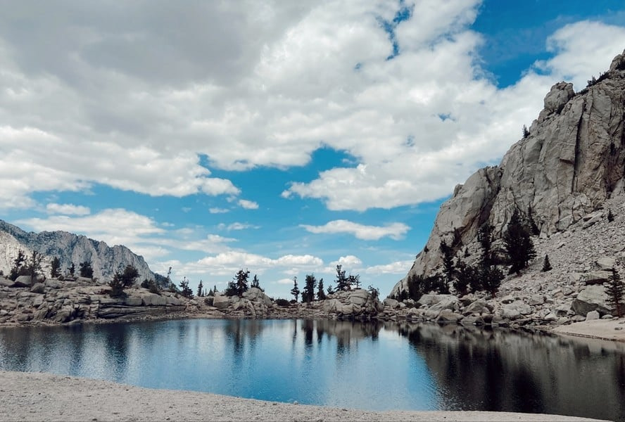
What are the Climate Zones on Whitney?
Mount Whitney spans four climate zones:
Foothill (6,000–8,000 feet/1,829–2,438 m) – Pinyon pine, sagebrush, and dry granite dominate the Whitney Portal area. Temperatures reach 80–90°F (27–32°C) in summer.
Montane (8,000–10,500 feet/2,438–3,200 m) – Lodgepole pine and fir forests offer shade and cooler air. Outpost Camp sits in this zone, with highs in the 60s°F (16–20°C) and nighttime lows in the 30s°F (0–4°C).
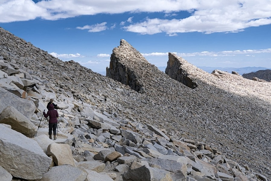
Subalpine (10,500–12,000 feet/3,200–3,658 m) – Trees thin out and meadows fade into talus fields. Trail Camp lies here. Cold nights, frost, and wind are normal.
Alpine (above 12,000 feet/3,658 m) – Nothing grows. Just rock, snowfields, and occasional patches of ice. Wind chill can drop below freezing even in August. Weather changes fast.
How Many Climbing Routes Are on Whitney?
Whitney has several established routes, each with different demands.
Mount Whitney Trail (Main Trail) – This is the standard path from Whitney Portal. It’s well-marked, non-technical, and suitable for fit hikers. The round trip is 22 miles (35 km) with 6,100 feet (1,859 m) of gain. Most hikers start around 2–4 am to summit before thunderstorms.
Mountaineer’s Route – First established by John Muir in 1873, this route starts from the North Fork of Lone Pine Creek. It climbs steeply to Iceberg Lake, then ascends a Class 3 chute to the summit plateau. It’s shorter (10–14 miles/16–22 km round trip) but more technical. Requires route finding and scrambling skills. Ice axe and crampons may be needed into July.
East Face and East Buttress – These are technical alpine rock climbs rated Class 5.6 to 5.8. They follow dramatic granite walls from Iceberg Lake. Climbers use ropes, cams, and protection. These routes are only for experienced trad climbers with high-altitude competence.
Whitney-Russell Traverse – A long, exposed link-up from Mount Russell to Whitney via the North Ridge. Class 3–4 terrain with major exposure and little bailout. Rarely done except by experienced scramblers.
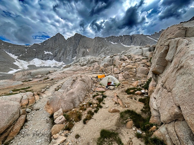
What is Summit Day Like?
For backpackers, summit day starts before sunrise at Trail Camp (12,000 feet/3,658 m). From there, the route climbs 1,600 feet (488 m) up 97 switchbacks to Trail Crest. After cresting the ridge, the trail cuts across the western slope, with steep drop-offs and frequent wind. The final stretch rises gradually to the summit hut.
Day hikers start at Whitney Portal in the dark, usually between 1:00 and 3:00 am. They cover the full 22-mile (35 km) round trip with over 6,100 feet (1,859 m) of gain in one push. The early start is necessary to avoid afternoon storms and to give enough margin for descent.
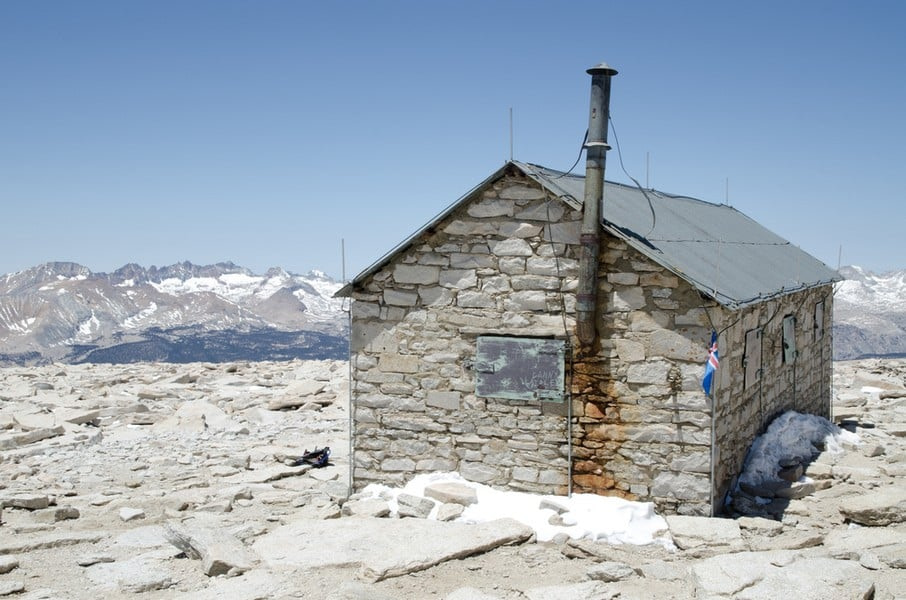
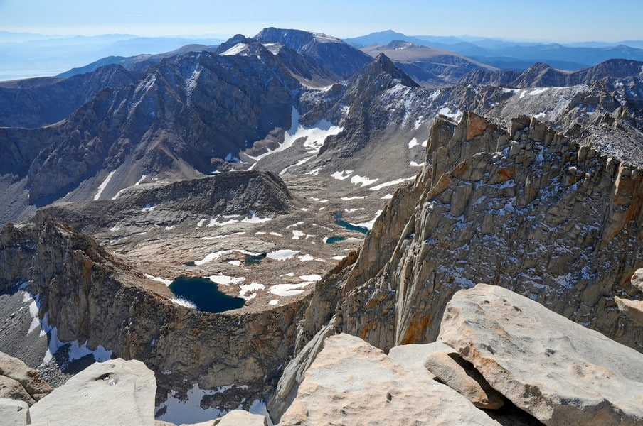
The summit is broad and flat. A stone shelter, built in 1909, marks the highest point in the contiguous United States. Views on clear days stretch across the Great Western Divide and east to the deserts of Death Valley.
The descent is long and draining. For day hikers, it can feel like a second mountain. Most people finish between 10 and 16 hours after starting. Backpackers return to Trail Camp to rest before descending the next morning.
How Much Does it Cost to Climb Whitney?
Permits are required and cost $15 per person, plus a $6 application fee. If selected in the lottery, your total cost for the climb will be $21. Camping is free with a valid permit.
There is no guide requirement, and most hikers go unguided. However, guided trips on the Mountaineer’s Route or technical climbs can range from $700 to $1,500 depending on duration and services.
How Dangerous is Whitney?
Whitney is safer than it seems but still has real risk. Falls, lightning, exhaustion, altitude sickness, and dehydration cause most incidents. Deaths are rare but not unheard of. Several hikers have fallen off the ridge. Thunderstorms have struck climbers near the summit. Unprepared hikers have collapsed from AMS, and others have gotten lost after dark.
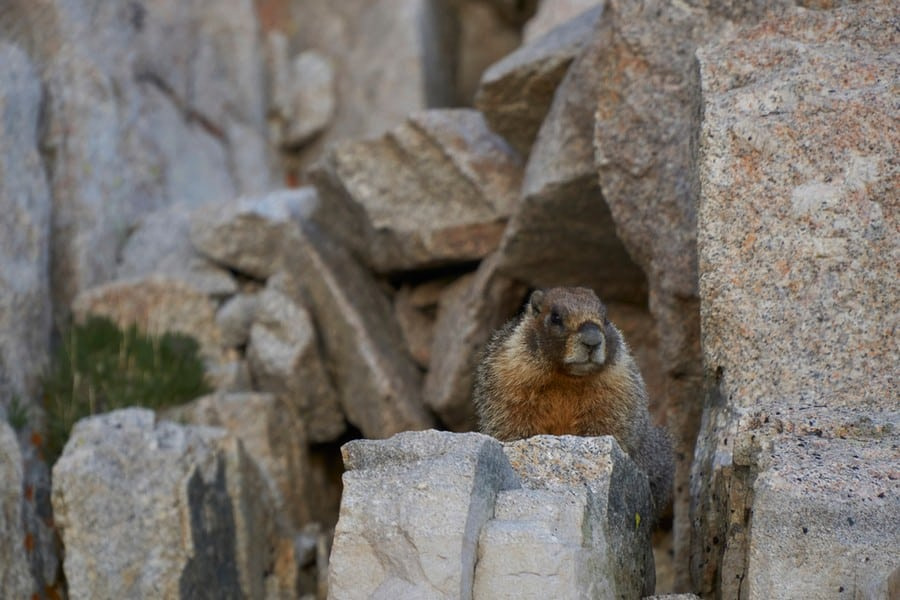
What Animals Live on Whitney?
Mule deer, black bears, marmots, pikas, and chipmunks live in the lower and middle elevations. Bears frequent Whitney Portal and will raid cars or packs. Bear canisters are required above 10,000 feet (3,048 m). Above tree line, marmots and pikas scavenge crumbs near camps. Bighorn sheep are rare but sometimes seen. Raptors and Clark’s nutcrackers fly overhead. Insects are minimal but can be heavy at mid-elevations in early summer.
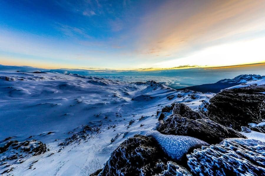
How Does Mount Kilimanjaro Compare to Whitney?
Whitney is shorter but more physically demanding because of the pace and lack of support.
Most Whitney ascents are done as day hikes, going from the trailhead to summit and back in a single, grueling push. This entails a long distance and significant elevation gain at high altitude while carrying your own food, water, and gear. Backpacking involves hauling gear to Trail Camp and summiting the next day.
Kilimanjaro is higher and longer, but supported. The mountain much taller, over 4,800 feet (1,463 m) higher, than Whitney. However, it is easier because the ascent is gradual and porters carry most of the gear for you. You hike with a light daypack, sleep in tents, and acclimatize slowly.
Whitney’s main trail is non-technical but harder than it looks. The Mountaineer’s Route and technical climbs require scrambling or rope skills. Kilimanjaro stays on well established trails and no technical climbing gear is required.
The weather on Kilimanjaro is more stable and predictable. Its equatorial location means it has two climbing seasons tied to its dry periods. On Whitney, weather shifts fast. Thunderstorms can hit with little warning. Lightning is a real threat above tree line and snow can fall in any month. Winds often exceed 40 mph (64 km/h) near the summit. In early season, snow and ice make the switchbacks dangerous.
Mount Whitney is excellent training for Kilimanjaro. It tests your altitude tolerance and endurance. The trail is long, steep, and relentless, similar to summit day on Kilimanjaro. Note that a fast Whitney hike doesn’t prove or disprove that you can handle Kilimanjaro’s altitude. But it does show you have the legs and lungs to push through long, steep climbs with limited rest. If you can complete Whitney as a day hike, you’re physically very well prepared for Kilimanjaro.


")


")