


Where is Mount Rainier Located?
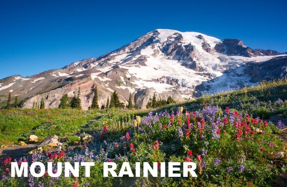
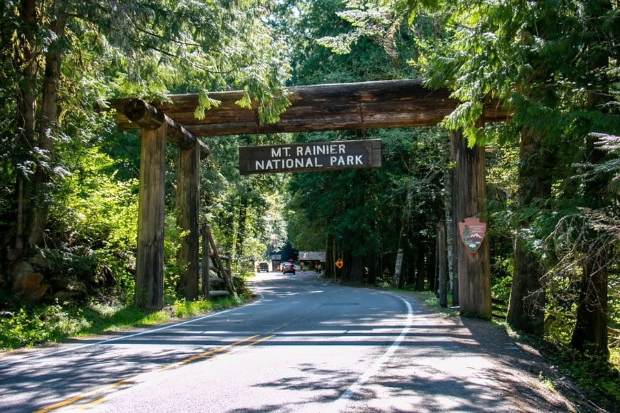
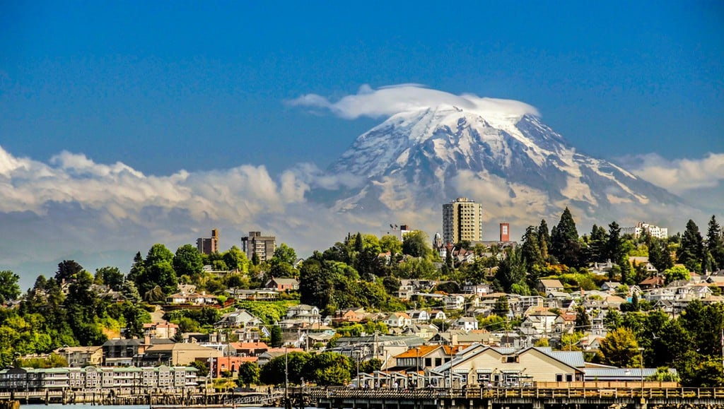
Mount Rainier is located inside Mount Rainier National Park in Washington State in the United States. It rises in the Cascade Range, 60 miles (97 km) southeast of Seattle and 110 miles (177 km) northeast of Portland.
How Tall is Mount Rainier?
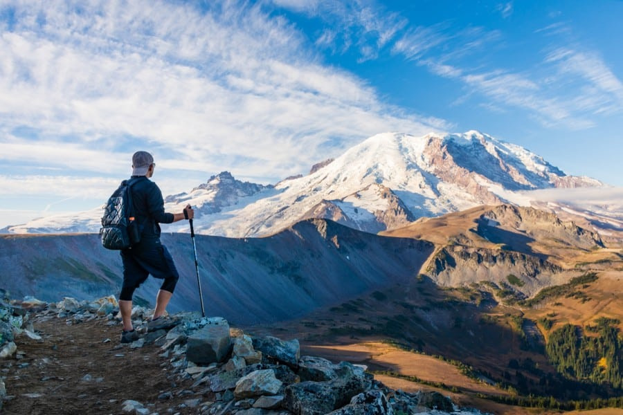
Rainier is 14,411 feet (4,392 m) tall. It is the 5th highest peak in the contiguous United States, after Whitney, Elbert, Massive, and Harvard.
How Was it Formed?
Rainier is a stratovolcano built by successive eruptions along the Cascadia Subduction Zone. It sits on the eastern edge of the Pacific Ring of Fire, a zone in the Pacific Ocean that experiences frequent volcanic activity and earthquakes. This region contains several major and minor tectonic plates that interact to create geological disturbances.
Off Washington’s coast, the Juan de Fuca Plate slowly slides under North America a few inches per year. As it sinks deeper, it heats up and forms magma below the crust. The magma rises through cracks and gathers in chambers. Rainier’s steep cone was formed through repeated eruptions over hundreds of thousands of years, stacking lava and ash layers. The volcano remains active today. Fumaroles in the summit crater still vent heat and gases.
What Does the Name Mean?
British explorer George Vancouver named the mountain Mount Rainier in 1792 to honor his friend Rear Admiral Peter Rainier. Peter Rainier (1741–1808) was a British Royal Navy officer. He spent much of his career commanding ships in the East Indies during the late 18th century, protecting trade routes and fighting in the French Revolutionary Wars.
The Puyallup Tribe from western Washington calls the mountain Tahoma or Tacobet, loosely translated as “the source of waters.” Tahoma remains widely used by Indigenous communities and many locals.
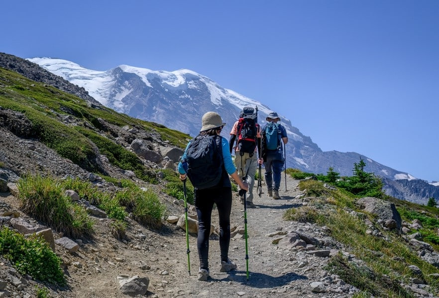
How Long Does it Take to Climb?
The standard and most popular route, Disappointment Cleaver, takes three days. Other technical routes see far fewer ascents. They usually take three to five days depending on length, bivy spots, weather, and route finding needs.
How Hard is it to Climb Rainier?
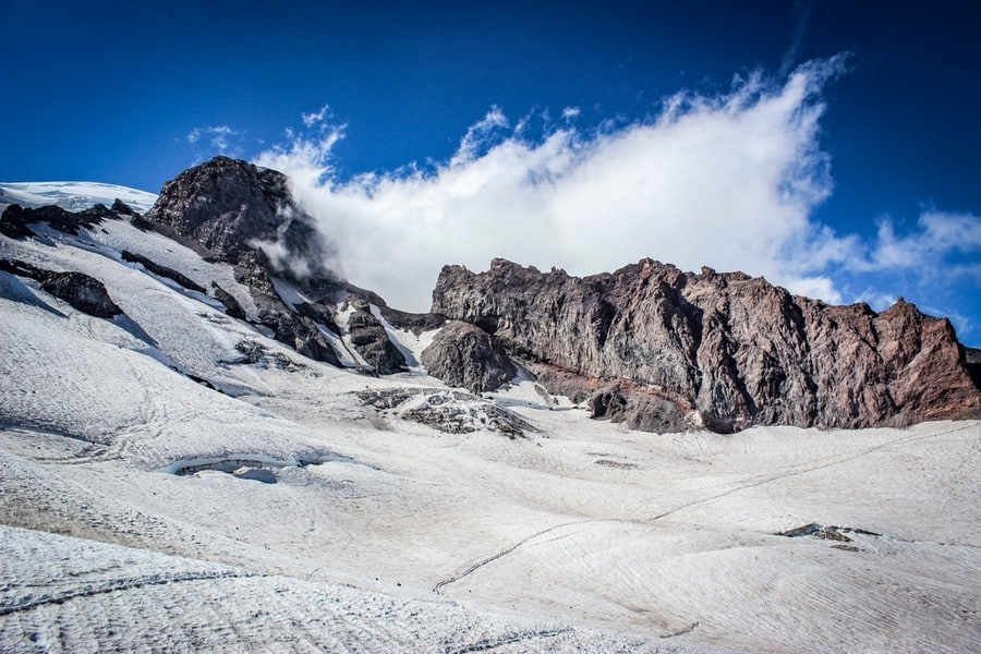
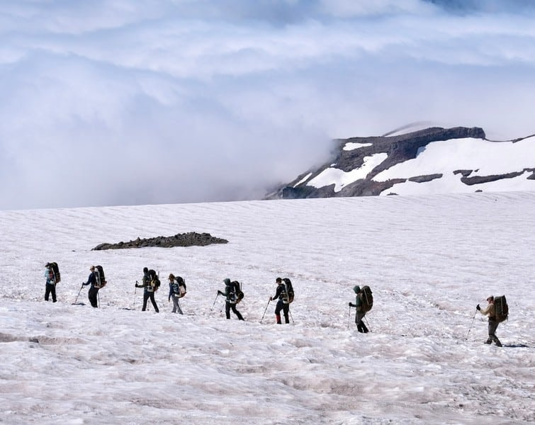
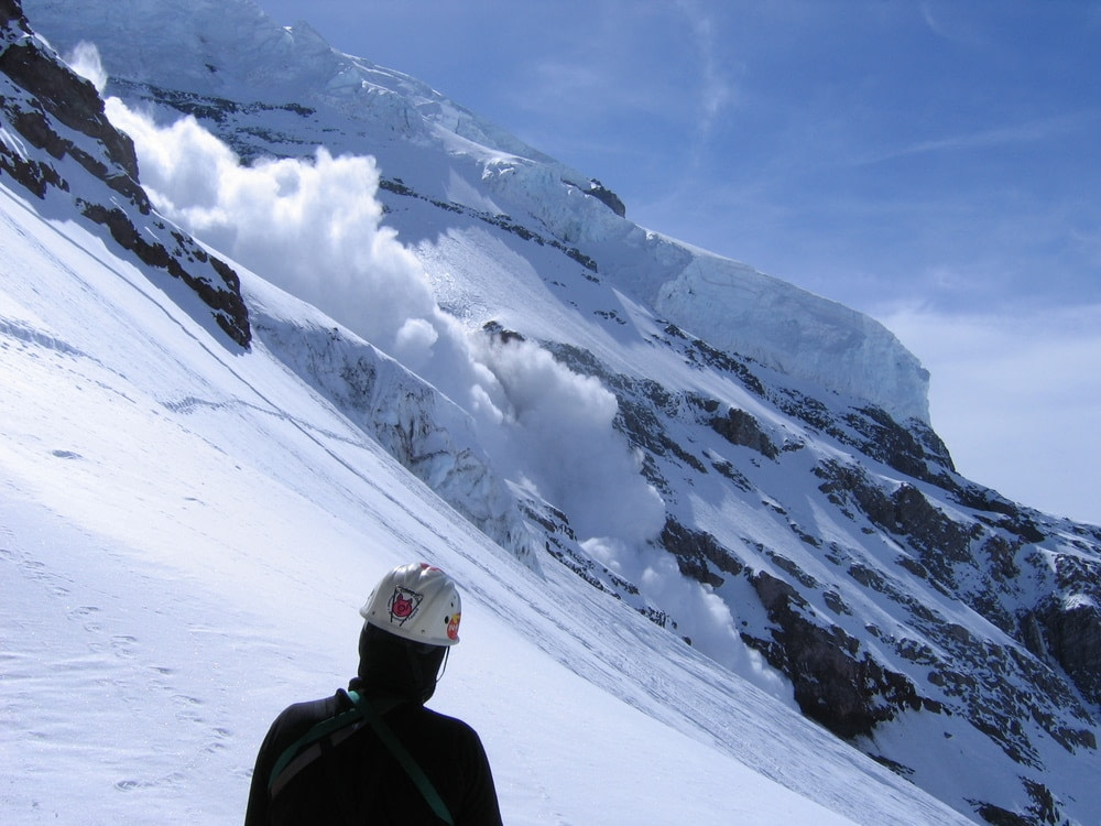
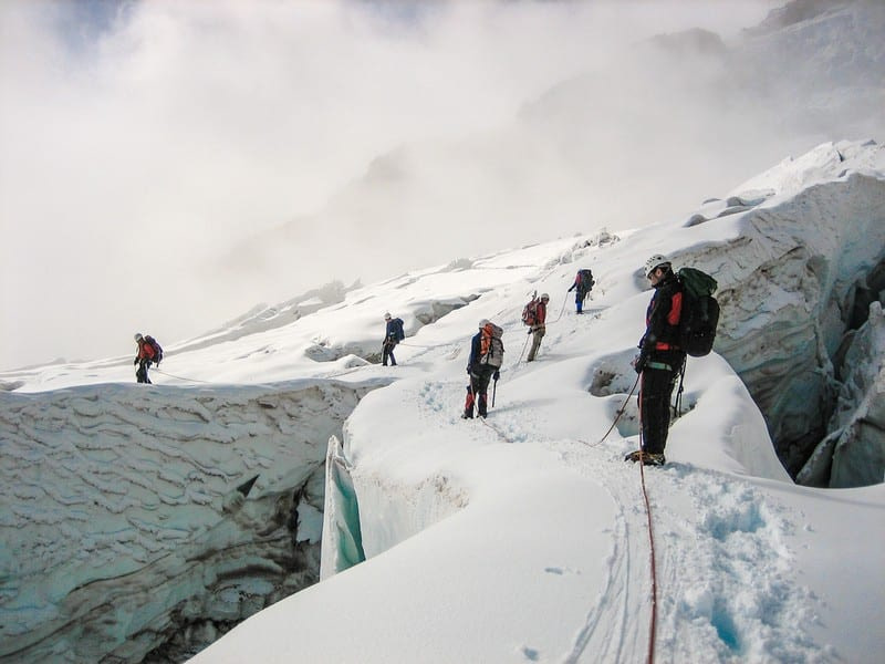
Mount Rainier is a challenging climb, requiring significant physical and mental preparation. It blends moderate technical terrain with heavy objective risk. Climbers must navigate crevasses, seracs, rockfall, and avalanche slopes while wearing crampons and carrying ice axes. Roped glacier travel is mandatory above Camp Muir or Emmons Flats.
Though trips are short, the packs can still weigh 40 to 50 pounds (18 to 23 kg) when hauling group gear and ropes. Summit day gains roughly 4,300 feet (1,311 m) and takes 8 to 14 hours round trip. Rapid elevation gain increases acute mountain sickness risk.
Storms can hammer the mountain year round. Winds commonly exceed 50 mph (80 km/h) on the upper flanks. Whiteouts disorient even experienced teams, and bridges over crevasses can collapse without warning. Objective hazards increase in July and August as snow thins and rock and ice fall. Technical skills needed include self arrest, crampon technique on 40 degree slopes, running belays, and crevasse rescue systems. Poor preparation leads to many evacuations each season.
What is the Success Rate on Rainier?
National Park Service statistics show annual summit success hovers around 50%. Well guided teams enjoying stable weather often top 70%, while unguided attempts can drop below 40%. Early and late season snow bridges, heat related icefall, and fatigue drive most turn arounds. Proper start time and continuous hydration improve odds. Many failures occur from underestimating the length of the summit push and descending exhausted.
Can Beginners Climb Rainier?
First time mountaineers can succeed with a reputable guide and strong cardio. They still need basic crampon, self arrest, and rope travel skills, usually taught during a one day glacier school before the climb. Participants must climb steady for several hours at a moderate pace while carrying a pack. Unguided ascents demand prior glacier experience, proven rescue skills, and solid navigation abilities. A heavy snow year raises difficulty for novices because route finding becomes more complex.
Who Was the First Person to Climb Rainier?
On August 17, 1870, Hazard Stevens and Philemon Van Trump successfully sumnmited Mount Rainier using what is now the Gibraltar Ledges route.
Hazard Stevens was an American Civil War officer and politician in Washington Territory. Philemon Van Trump was a local climber and explorer who promoted tourism in the Cascades.
Their success followed earlier failed attempts during the 1850s and 1860s. The climb helped spur federal interest in conserving the area, leading to national park designation in 1899.
How Many People Climb Rainier per Year?
From 10,000 to 12,000 climbers attempt Rainier each year, most of which occurs during the three month peak season. The park enforces a permit system and group size limits to reduce crowding and resource impacts.
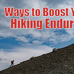
How Do You Train to Climb Rainier?
The goal is is to arrive able to hike uphill for hours while carrying weight. So cardiovascular fitness is key. Train by doing weekly long hikes with a 30 to 40 pound (14 to 18 kg) pack. Add shorter mid‑week hikes, climbs on stairs or treadmill sessions at 15% grade. If possible, include some leg strength and conditioning exercises: regular step‑ups, lunges, squats, and loaded carries.
For guided ascents, the program typically includes glacier school which teaches the minimum technical skills required, such as crampon use and self arrest.
What is the Best Time to Climb Rainier?
Prime season runs from late May through early August.
Weather drives success on Rainier more than on most continental peaks. The mountain sits near the Pacific, squarely in the storm track. Conditions on Rainier change fast. A calm, sunny morning at Paradise can turn into whiteout at 12,000 feet (3,658 m) in an hour. Expect temperatures around 25°F (-4°C) at Camp Muir and 5°F (-15°C) on the summit. Wind speeds of 50 mph (80 km/h) or more are common above 12,000 feet (3,658 m).
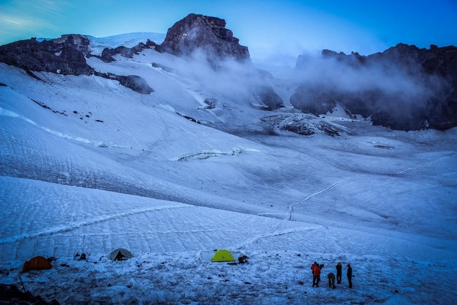
Climbers often wait two or three days at Camp Muir for a short weather break, then rush the summit when skies clear. On Rainier, timing and flexibility matter as much as fitness.
Early season (late May – early June)
Pros: Snow bridges stay thick, hiding crevasses. Fixed lines and ladders are freshly installed. Routes often follow direct snow ramps, saving distance. Crowds are lighter and parking easier.
Cons: Temperatures stay cold, so summit days can hit 0 °F (‑18 °C). Storms linger from winter, bringing whiteouts and deep new snow. Avalanche risk is higher on loaded slopes. Extra gear may be required, such as snowshoes and heavier insulation.
Mid‑season (mid‑June – July)
Pros: Days are long with up to sixteen hours of light. Weather windows widen and winds ease. Guides keep the boot‑pack well maintained, so navigation is straightforward. Crevasses are still bridged and ladders remain solid. This period has the highest success rates.
Cons: It is busy. Permit quotas fill months ahead. High camps get crowded and rockfall starts to increase as the snowpack thins. Afternoon sun softens snow, slowing travel on the descent.
Late season (August – early September)
Pros: Fewer climbers mean quieter routes and open camps. Stable high‑pressure systems bring clear skies. Snow is firm in the morning, giving crisp crampon purchase.
Cons: Crevasse bridges sag or collapse, forcing long detours and extra ladder work. The Cleaver and other ridges shed rocks all afternoon. Ice replaces snow on key pitches, raising technical difficulty. Some variations become impassable. Summit success rates drop as objective hazards rise.
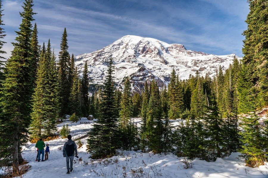
What are the Different Climate Zones on the Mountain?
The National Park Service groups the mountain into forest, subalpine, and alpine belts.
Below 5,000 feet (1,524 m) lies the lowland forest. Thick stands of western hemlock, Douglas fir, and cedar crowd the slopes. Summer temperatures range between 40 and 70 °F (4 to 21 °C), and Pacific storms keep the understory soaked for much of the year.
Subalpine meadows stretch from about 5,000 to 7,000 feet (1,524 to 2,134 m). The trees thin and heather, lupine, and paintbrush blanket the open ground in the summer. Cool nights and regular fog linger, while early‑season mosquitoes emerge.
The alpine zone begins above 7,000 feet (2,134 m). Here, rock rises above snowfields and glaciers. Air temperatures hover near freezing even in midsummer, and sudden squalls can erase visibility within minutes. Above 10,000 feet (3,048 m), snow and ice persist year‑round.
How Many Climbing Routes Are on Rainier?
There are over 25 named routes on Rainier. However, only three paths see heavy, season-long traffic.
Most people use the Disappointment Cleaver route. The Emmons–Winthrop and Kautz routes are also regularly climbed. During the early season, some utilize the Ingraham Direct route. Liberty Ridge gets a trickle each year. Everything else is rarely climbed.
Disappointment Cleaver
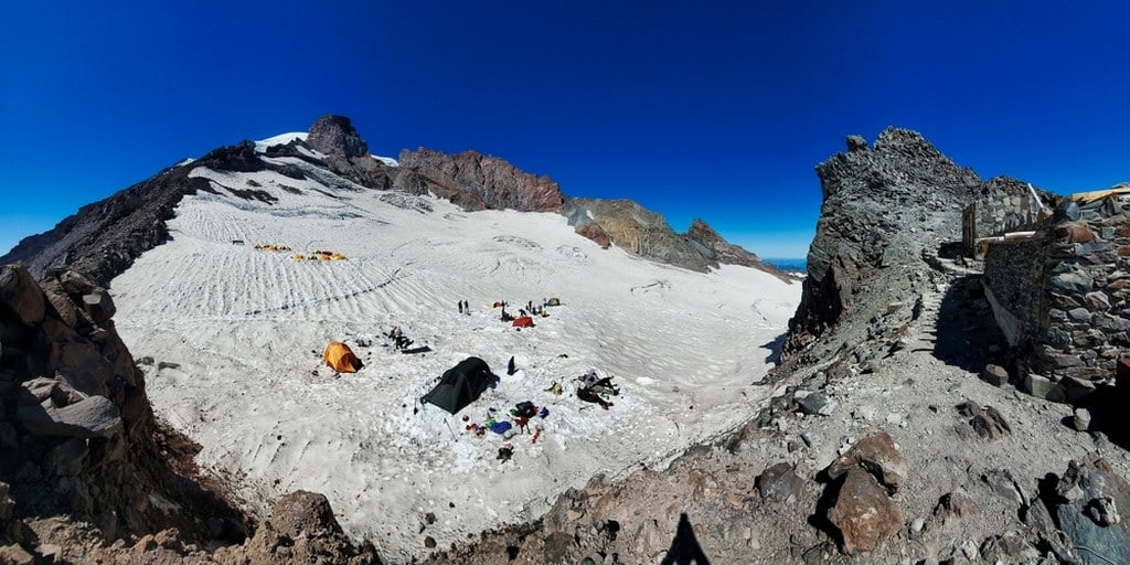
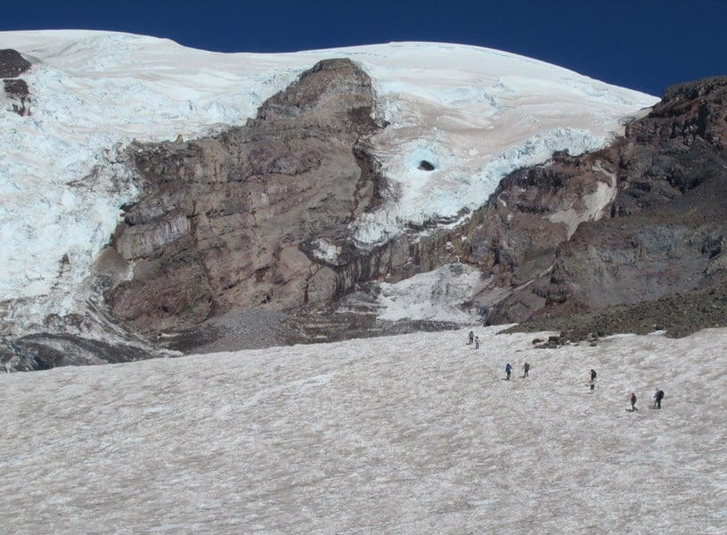
The Disappointment Cleaver route is the standard and most popular path up Rainier. It starts at Paradise, climbs the Muir Snowfield to Camp Muir, then crosses two glaciers before arriving at the crater. The terrain is moderate but exposed. Fixed boot tracks, wands, and guide traffic make navigation straightforward in season.
Here is the typical three day itinerary for the Disappointment Cleaver route:
- Day 1 (Paradise to Camp Muir) – Start at 5,400 feet (1,646 m). Follow the paved Skyline Trail, then the Muir Snowfield. Reach Camp Muir at 10,188 feet (3,105 m) after 4–6 hours and gain 4,800 feet (1,463 m).
- Day 2 (Camp Muir to Ingraham Flats) – Rope up at dawn. Cross the Cowlitz Glacier, scramble through Cathedral Gap, and set camp on Ingraham Flats at 11,100 feet (3,383 m). Afternoon is for skills review and rest.
- Day 3 (Summit Push and Descent) – Leave around midnight. Ascend the Cleaver ridge, then weave through crevasses on the upper Ingraham Glacier. Top Columbia Crest at 14,411 feet (4,392 m) after 6–8 hours. Descend all the way to Paradise the same day.
Emmons–Winthrop Glacier
The Emmons–Winthrop Glacier is the longest continuous glacier in the contiguous United States, stretching roughly 5 miles (8 km). This route starts on the northeast side at White River Campground. Slightly less steep but heavily crevassed. Often used for larger independent groups seeking less crowd pressure. Teams carry loads farther and navigate more route changes.
Kautz Glacier
This route approaches from the south‑west and climbs two steep ice gullies above Camp Hazard. The slope reaches 45 to 50 degrees, so front‑pointing and two ice pitches are mandatory. It is a step up in technical skill.
Ingraham Direct
Ingraham Direct is a shorter, more direct line to the summit. It starts along the same path as the Disappointment Cleaver, but stays on the Ingraham Glacier, bypassing the Cleaver. This is only possible in the early season when snow bridges are solid. By end of May, crevasse openings force parties back to the Disappointment Cleaver track.
Liberty Ridge
Liberty Ridge is the most difficult of the commonly climbed routes on Mount Rainier. It runs up the narrow north ridge. The sustained 50‑degree ice, exposure, and serac hazard demand advanced alpine ability. It takes longer and sees few summits compared with the standard route.
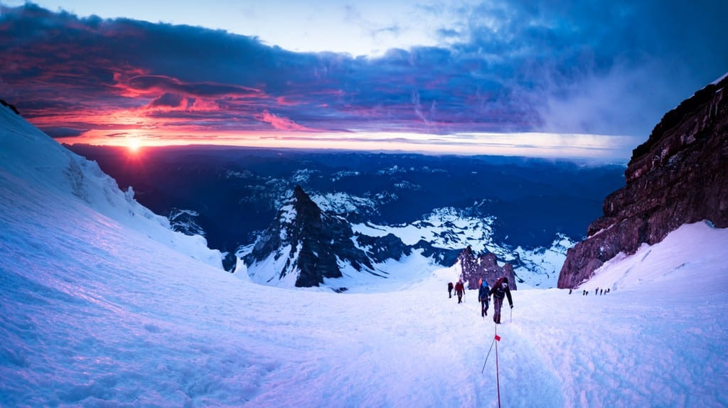
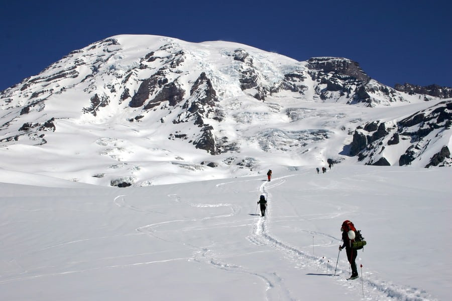
What is Summit Day Like?
On the Disappointment Cleaver route, teams wake at midnight to begin the summit bid from Camp Muir or Ingraham Flats. Climbers cross the Ingraham Glacier and step onto the Disappointment Cleaver, climbing on mixed rock and snow. Above 12,300 feet (3,749 m) they rejoin the glacier and thread between widening crevasses. The slope eases into the broad summit crater and a short walk across the bowl tags the summit at 14,411 feet (4,392 m).
The round trip usually runs 8 to 14 hours. Most parties descend all the way to Paradise the same day.
How Much Does it Cost to Climb Rainier?
Guided three‑day climbs on the standard route run about $1,400 to $2,500 per person. Rental gear (boots, crampons, axe, bag) can add $200 to $400. Unguided teams skip guide fees but still pay permits, travel, and any rental costs.
How Many People Have Died on Rainier?
Since records began in 1897, more than 430 climbers have died while climbing Mount Rainier. Roughly two to three climbers die on Rainier each year on average. Some seasons see none; bad years see five or more. Numbers swing with weather, route condition, and total attempts.
The main causes of accidents and deaths on Rainier are weather, falls into crevasses, rock or icefall, avalanches, hypothermia, and medical issues like altitude illness or cardiac events.
What Animals Live on Rainier?
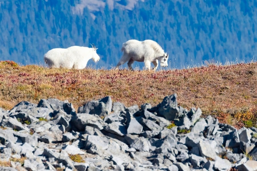
Rainier’s slopes encompass distinct climate zones that support different wildlife.
Wet lowland forests produce cones, berries, and insects for deer, bears, squirrels, and birds. Dense timber and downed logs give shelter and den sites. Higher, the subalpine meadows bloom for a few weeks, delivering rich grasses and wildflowers for marmots, goats, and pollinators. In the alpine zone, vegetation thins to lichens, cushion plants, and scattered sedges along rock and snow edges. Pikas and rodents cache plants in rock piles for winter. Glaciers and snowfields release steady meltwater that sustains rivers, wetlands, and salmon runs below, cycling nutrients back upstream through predators like bears and eagles. The result is a short, intense growing season that each species exploits quickly before winter shuts it down.
How Does Mount Kilimanjaro Compare to Rainier?
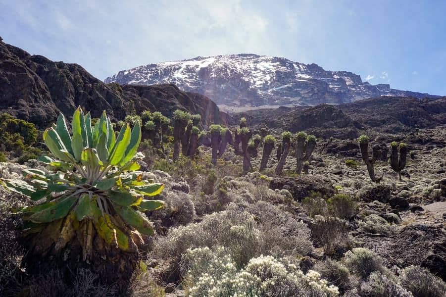
The main difference is that Mount Rainier is a technical climb while Kilimanjaro is a hike. Climbing Rainier requires crampons, ice axe, and rope travel. You move on glaciers, cross ladders, and manage rock and icefall. Guides will teach you the basics during the expedition. Kilimanjaro hikes are on well established trails that require no technical skills.
Kilimanjaro is a fully supported trek. Porters carry tents, food, cookware, and your main duffel. You hike with a light daypack, usually 10 to 15 pounds (4.5 to 7 kg). Rainier is the opposite. You carry everything yourself plus group gear. Packs commonly weigh 30 to 40 pounds (14 to 18 kg). Even guided trips expect clients to shoulder their share.
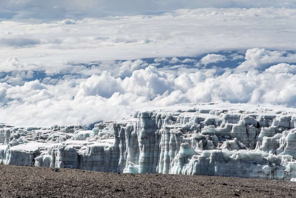
In terms of altitude, Rainier is much lower. It tops out at 14,411 feet (4,392 m), while Kilimanjaro reaches 19,341 feet (5,895 m). Rainier falls into the category of very high altitude (12,000–18,000 ft / 3,658–5,486 m). Kilimanjaro is considered extreme altitude (above 18,000 ft / 5,486 m). Altitude symptoms are still possible on Rainier, but the physiological stress is generally less.
Climbs on Rainier are fast, with standard trips lasting 2 to 3 days. Kilimanjaro’s standard routes run 5 to 9 days. The quick push on Rainier leaves little time to acclimatize. Pack weight, combined with a faster schedule, is a key reason people get dropped. Cardiovascular fitness is far more important on Rainier. Guides will turn around those who can’t keep up.
The weather is harsher on Rainier. Washington’s maritime storms bring whiteout, high winds, and rapid temperature drops even in July. Kilimanjaro’s equatorial weather is comparatively stable and mild.
Both Kilimanjaro and Rainier are accessible to motivated first‑timers. However Rainier demands more fitness and competence. It should be seen as a step up in difficulty due to the heavier pack, faster schedule, glacier skills, and potential weather.


")
")

")


